Showing posts with label Colorado. Show all posts

Monday, 18 November 2013


Garden Of The Gods, Colorado:


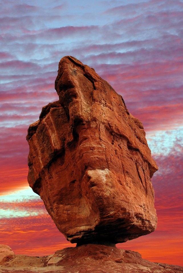
Garden of the Gods is a public park located in Colorado Springs, Colorado, USA. It was designated a National Natural Landmark in 1971.The Garden of the Gods red rock formations were created during a geological upheaval along a natural fault line millions of years ago. Archaeological evidence shows that prehistoric people visited Garden of the Gods about 1330 BC. About 250 BC Native American people camped in the park. They are believed to have been attracted to wildlife and plant life in the area and used overhangs created by the rocks for shelter. There are many native peoples who have reported a connection to Garden of the Gods, including Ute, Comanche, Apache, Kiowa, Shoshone, Cheyenne, Pawnee and Lakota people.The Utes oral traditions tell of their creation at the Garden of the Gods. Petroglyphs have been found in the park that are typical of early Utes. They found red rocks to have a spiritual connection and camped near Manitou Springs and the creek near Rock Ledge Ranch bordering Garden of the Gods. Other tribes traveled through Garden of the Gods.The Old Ute Trail went past Garden of the Gods to Ute Pass and led later explorers through Manitou Springs. Starting in the 16th century, Spanish explorers and later European American explorers and trappers traveled through the area, including Lt. John C. Freemont and Lt. George Frederick Ruxton who recorded their visits in their journals.The area was first called Red Rock Corral.Then, in August 1859, two surveyors who helped to set up Colorado City explored the site. One of the surveyors, M. S. Beach, suggested that it would be a "capital place for a beer garden." His companion, the young Rufus Cable, awestruck by the impressive rock formations, exclaimed, "Beer Garden! Why it is a fit place for the gods to assemble. We will call it the Garden of the Gods."In 1879, Charles Elliott Perkins, a friend of William Jackson Palmer, purchased 480 acres of land that included a portion of the present Garden of the Gods. Upon Perkin’s death, his family gave the land to the City of Colorado Springs in 1909, with the provision that it would be a free public park. Palmer had owned the Rock Ledge Ranch and upon his death it was donated to the city.Helen Hunt Jackson wrote of the park, "You wind among rocks of every conceivable and inconceivable shape and size... all bright red, all motionless and silent, with a strange look of having been just stopped and held back in the very climax of some supernatural catastrophe."Having purchased additional surrounding land, the City of Colorado Springs' park grew to 1,364 acres. In 1995 the Garden of the Gods Visitor and Nature Center was opened just outside of the park.The outstanding geologic features of the park are the ancient sedimentary beds of deep-red, pink, and white sandstones, conglomerates and limestone that were deposited horizontally, but have now been tilted vertically and faulted by the immense mountain building forces caused by the uplift of the Rocky Mountains and the Pikes Peak massif. The following Pleistocene Ice Age resulting in erosion and glaciation of the rock, creating the present rock formations. Evidence of past ages; ancient seas, eroded remains of ancestral mountain ranges, alluvial fans, sandy beaches and great sand dune fields can be read in the rocks.The resulting rocks had different shapes: toppled, overturned, stood-up, pushed around and slanted. Balanced Rock, a Fountain formation, is a combination of coarse sand, gravel, silica and hematite. It is hematite that makes the large balancing rock rock red. It toppled off of a ledge, rested on sand that was worn away at the base. Gateway Rock and Three Graces are stood-up rocks that had been pushed up vertically. The Tower of Babel is Lyons formation, a stone made of fine sand from an ancient beach.The Garden of the Gods Park is a rich ecological resource. Retired biology professor Richard Beidleman notes that the park is "the most striking contrast between plains and mountains in North America" with respect to biology, geology, climate, and scenery. Dinosaur species Theiophytalia kerri was found in the park in 1878, and studies of the skull in 2006 reveal it to be a new species. A honey ant never before recorded was also discovered in 1879 and named for the park. Mule deer, bighorn sheep, and fox abound in this area. The park is also home to more than 130 species of birds including white-throated swifts, swallows and canyon wrens.

Source:
Picture:Link:
Wikipedeia:Link:
Read More 0 comments

Wednesday, 23 October 2013


 Rocky Mountains, Colorado:


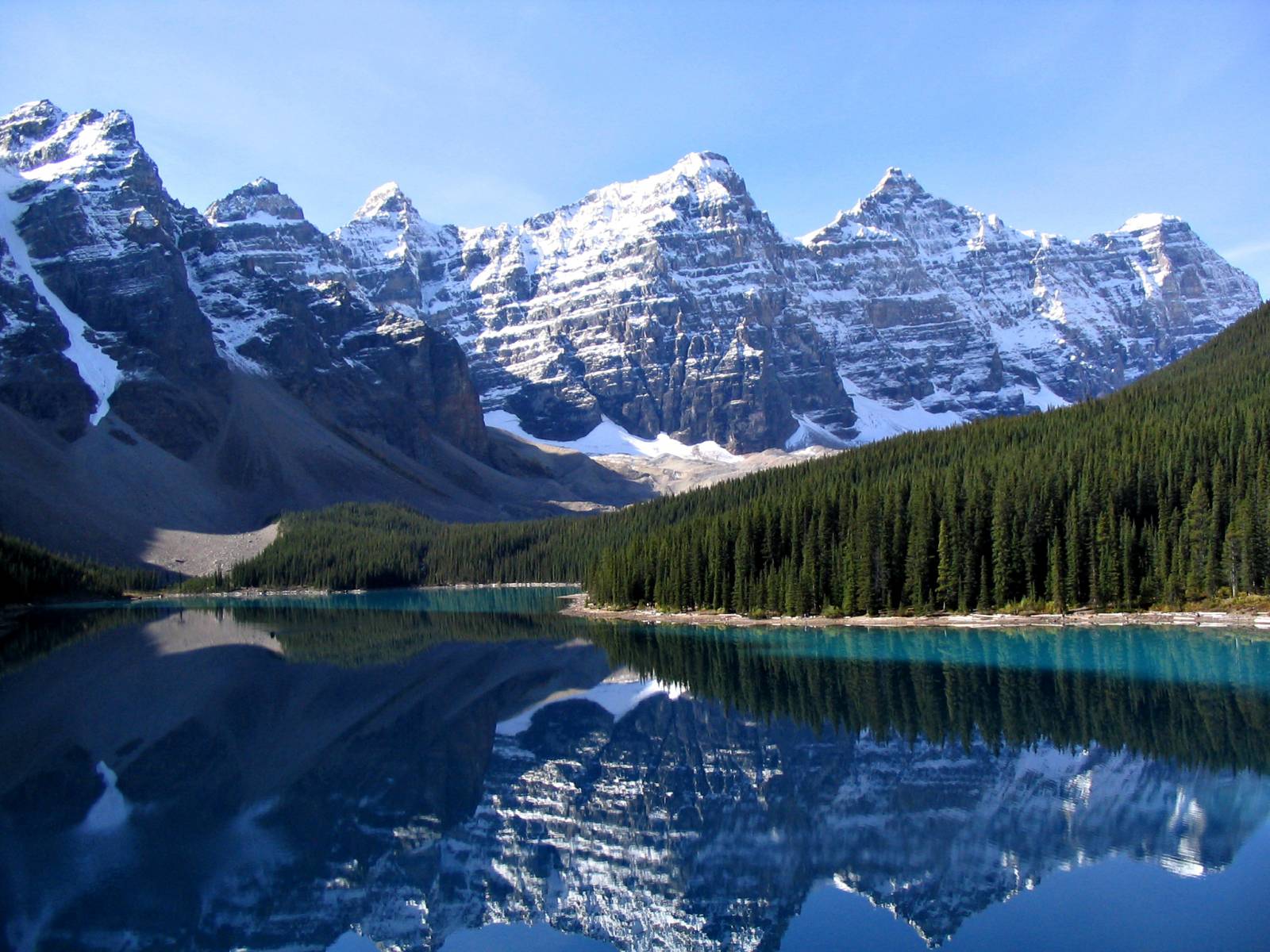
The Rocky Mountains, commonly known as the Rockies, are a major mountain range in western North America. The Rocky Mountains stretch more than 3,000 miles from the northernmost part of British Columbia, in western Canada, to New Mexico, in the southwestern United States. Within the North American Cordillera, the Rockies are somewhat distinct from the Pacific Coast Ranges and the Cascade Range and Sierra Nevada which all lie farther to the west.The Rocky Mountains were initially formed from 80 million to 55 million years ago during the Laramide orogeny, in which a number of plates began to slide underneath the North American plate. The angle of subduction was shallow, resulting in a broad belt of mountains running down western North America. Since then, further tectonic activity and erosion by glaciers have sculpted the Rockies into dramatic peaks and valleys. At the end of the last ice age, humans started to inhabit the mountain range. After Europeans, such as Sir Alexander Mackenzie and the Lewis and Clark expedition, started to explore the range, minerals and furs drove the initial economic exploitation of the mountains, although the range itself never became densely populated.Currently, much of the mountain range is protected by public parks and forest lands, and is a popular tourist destination, especially for hiking, camping, mountaineering, fishing, hunting, mountain biking, skiing, and snowboarding.The Rocky Mountains are commonly defined as stretching from the Liard River in British Columbia south to the Rio Grande in New Mexico. Other mountain ranges continue beyond those two rivers, including the Selwyn Range in Yukon, the Brooks Range in Alaska, and the Sierra Madre in Mexico, but those are not part of the Rockies, though they are part of the American cordillera. The United States definition of the Rockies, however, includes the Cabinet and Salish Mountains of Idaho and Montana, whereas their counterparts north of the Kootenai River, the Columbia Mountains, are considered a separate system in Canada, lying to the west of the huge Rocky Mountain Trench, which runs the length of British Columbia from its beginnings in the middle Flathead River valley in western Montana to the south bank of the Liard River.The Rockies vary in width from 70 to 300 miles . Also west of the Rocky Mountain Trench, farther north and facing the Muskwa Range across the trench, are the Stikine Ranges and Omineca Mountains of the Interior Mountains system of British Columbia. A small area east of Prince George, British Columbia on the eastern side of the Trench, the McGregor Plateau, resembles the Rockies but is considered part of the Interior Plateau.The rocks in the Rocky Mountains were formed before the mountains were raised by tectonic forces. The oldest rock is Precambrian metamorphic rock that forms the core of the North American continent. There is also Precambrian sedimentary argillite, dating back to 1.7 billion years ago. During the Paleozoic, western North America lay underneath a shallow sea, which deposited many kilometers of limestone and dolomite.In the southern Rocky Mountains, near present-day Colorado, these ancestral rocks were disturbed by mountain building approximately 300Ma, during the Pennsylvanian. This mountain building produced the Ancestral Rocky Mountains. They consisted largely of Precambrian metamorphic rock forced upward through layers of the limestone laid down in the shallow sea.The mountains eroded throughout the late Paleozoic and early Mesozoic, leaving extensive deposits of sedimentary rock.Terranes started to collide with the western edge of North America in the Mississippian, causing the Antler orogeny. For 270 million years, the effects of plate collisions were focused very near the edge of the North American plate boundary, far to the west of the Rocky Mountain region. It was not until 80 Ma that these effects began to reach the Rockies.The current Rocky Mountains were raised in the Laramide orogeny from between 80 to 55 Ma.For the Canadian Rockies, the mountain building is analogous to a rug being pushed on a hardwood floor:the rug bunches up and forms wrinkles. In Canada, the terranes and subduction are the foot pushing the rug, the ancestral rocks are the rug, and the Canadian Shield in the middle of the continent is the hardwood floor.Further south, the growth of the Rocky Mountains in the United States was probably caused by an unusual subduction, where the Farallon plate dove at a shallow angle below the North American plate. This low angle moved the focus of melting and mountain building much farther inland than the normal 200 to 300 miles.It is postulated that the shallow angle of the subducting plate greatly increased the friction and other interactions with the thick continental mass above it. Tremendous thrusts piled sheets of crust on top of each other, building the extraordinarily broad, high Rocky Mountain range.


Source:
Picture:Link:
Wikipedeia:Link:
Read More 0 comments

Thursday, 17 October 2013

Bridal Veil Falls, Telluride, Colorado:

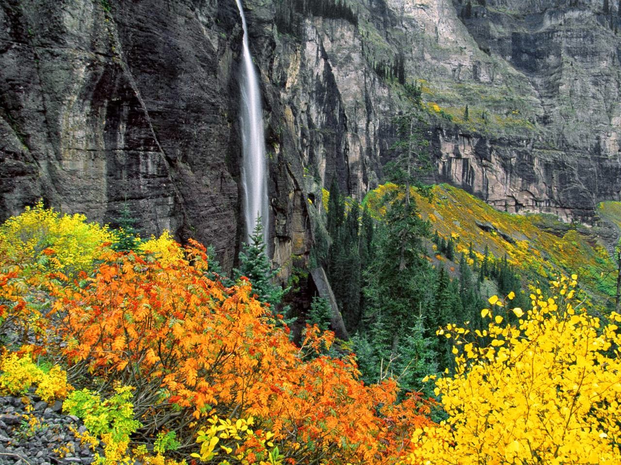
Bridal Veil Falls is a 365 foot waterfall at the end of the box canyon overlooking Telluride, Colorado. Hiking and off-road trails pass by the falls and the power plant at its top. In winter the frozen shape of the falls forms an imposing challenge to intrepid ice climbers.
Bridal Veil Falls is a two pronged waterfall.The trail past the falls continues on to mountain meadows and mountain lakes above 10,000 feet.The house/power plant atop the falls was restored, operated and lived in by Eric Jacobson. The power generated now provides about 25 percent of Telluride's demand for electricity. The plant was originally used to power the Smuggler-Union Mine and in winter requires an aerial tramway for access. It is the second-oldest operating AC generator in the United States, the first being the nearby Ames Hydroelectric Generating Plant by Ophir, Colorado. The Idarado Mining Company now owns and operates the power plant. It is listed on the National Register of Historic Places as the Smuggler-Union Hydroelectric Power Plant.The falls were opened briefly in the 1990s to ice climbers, but the area is private property so climbing has been legally prohibited since.Referred to as a "mega classic" and "the most difficult waterfall ice climb in North America" some climbers have trespassed to take a crack at the imposing and dangerous climb, but a land purchase proposal and an insurance deal may change the situation.Climbers were excited by the proposal in 2008 that would reopen the falls to climbers.Legendary climbers Jeff Lowe and Mike Wiess were known to have been the first to summit the falls in 1978, the effort having been broadcast on ABC’s Wide World of Sports.The area around Bridal Veil Falls is subject to avalanche and controlled shelling to create controlled slides is an event popular with spectators and photographers. Reaching the top of the falls in winter can be a precarious venture, even for the experienced family that call the plant home.


Source:
Picture:Link:
Wikipedia:Link:
Read More 0 comments