Showing posts with label California. Show all posts

Friday, 14 March 2014


Saratoga Valley, California


Saratoga is a city in Santa Clara County, California, USA. It is located on the west side of the Santa Clara Valley, directly west of San Jose, in the San Francisco Bay Area. The population was 29,926 at the 2010 census.Located on the Western edge of the Silicon Valley, Saratoga is known locally for its suburban small-town feel, wineries, and high-end boutiques. In 2008 CNN/Money ranked Saratoga number 4 in its listing of top-earning towns.Saratoga also was ranked by Forbes in 2009 as one of America's top 20 most-educated small towns.In 2010 Bloomberg Businessweek named Saratoga the most expensive suburb in California.Bloomberg Businessweek also named Saratoga's zip code 95070 the 18th richest zip code in America in 2011.Major attractions of Saratoga include Villa Montalvo, Hakone Gardens, and the Mountain Winery. The 2013 Home Listing Report listed Saratoga as the 3rd most expensive housing market in the United States.The European settlement of what is now Saratoga occurred in 1847, when William Campbell, constructed a sawmill about 2.5 miles southeast of the present downtown area. An early map noted the area as Campbell's Gap. In 1851 Martin McCarthy, who had leased the mill, built a toll road down to the Santa Clara Valley, and founded what is now Saratoga as McCarthysville.The toll gate was located at the present day intersection of Big Basin Way and 3rd St., giving the town its first widely used name: Toll Gate. In 1867 the town received a post office under the name of McCarthysville.Industry soon sprang up and at its pinnacle the town had a furniture factory, grist mill, tannery, and a paper factory. To commemorate this newfound productivity the town was renamed again in 1863 as Bank Mills. In the 1850s Jud Caldwell discovered springs which were called Pacific Congress Springs because the water had a mineral content similar to Congress Springs, in Saratoga Springs, New York. In 1865 the town received its final name, Saratoga, after the city in New York. At the same time a resort hotel called Congress Hall was constructed at the springs, named after the famous resort Congress Hall at Saratoga Springs, New York. California's Congress Hall attracted tourists to the area until it burned down in 1903.These events would eventually lead to Saratoga being listed as a California Historical Landmark in 1950.Downtown Saratoga, facing southwest at the intersection of Saratoga-Los Gatos Blvd. and Saratoga Ave and Big Basin Way/State Route 9, and Saratoga-Sunnyvale road.Saratoga became agricultural, as did much of the rest of the valley; a few vineyards and orchards from this period remain today. After World War II the town quickly became urbanized, and it incorporated in 1956 mostly to avoid being annexed to San Jose. A slogan during the campaign to incorporate the city of Saratoga was "Keep it rural," according to historian Willys I. Peck. Today the city serves as a bedroom community for upper-middle class Silicon Valley tech workers.


Source:
Picture:Link:
Wikipedia:Link:
Read More 0 comments

Friday, 28 February 2014


Death Valley National Park, California:


Death Valley National Park is a national park in the U.S. states of California and Nevada located east of the Sierra Nevada, occupying an interface zone between the arid Great Basin and Mojave deserts in the United States. The park protects the northwest corner of the Mojave Desert and contains a diverse desert environment of salt-flats, sand dunes, badlands, valleys, canyons, and mountains. It is the largest national park in the lower 48 states and has been declared an International Biosphere Reserve. Approximately 95% of the park is a designated wilderness area.It is the hottest and driest of the national parks in the United States. The second-lowest point in the Western Hemisphere is in Badwater Basin, which is 282 feet below sea level. The park is home to many species of plants and animals that have adapted to this harsh desert environment. Some examples include creosote bush, bighorn sheep, coyote, and the Death Valley pupfish, a survivor of much wetter times.A series of Native American groups inhabited the area from as early as 7000 BC, most recently the Timbisha around 1000 AD who migrated between winter camps in the valleys and summer grounds in the mountains. A group of European-Americans that became stuck in the valley in 1849 while looking for a shortcut to the gold fields of California gave the valley its name, even though only one of their group died there. Several short-lived boom towns sprang up during the late 19th and early 20th centuries to mine gold and silver. The only long-term profitable ore to be mined was borax, which was transported out of the valley with twenty-mule teams. The valley later became the subject of books, radio programs, television series, and movies. Tourism blossomed in the 1920s, when resorts were built around Stovepipe Wells and Furnace Creek. Death Valley National Monument was


Source:
Picture:Link:
Wikipedeia:Link:
Read More 0 comments

Saturday, 15 February 2014


Top of the Rock, Yosemite, California:


Yosemite Falls is the highest measured waterfall in North America. Located in Yosemite National Park in the Sierra Nevada of California, it is a major attraction in the park, especially in late spring when the water flow is at its peak.The total 2,425 feet from the top of the upper fall to the base of the lower fall qualifies Yosemite Falls as the sixth highest waterfall in the world, though with the recent discovery of Gocta Cataracts, it appears on some lists as seventh.In years of little snow, the falls may actually cease flowing altogether in late summer or fall. A very small number of rock climbers have taken the opportunity to climb the normally inaccessible rock face beneath the falls, although this is an extraordinarily dangerous undertaking; a single afternoon thunderstorm could restart the falls, sweeping the climbers off the face.Lower Yosemite Fall is easily accessible near the Yosemite Lodge in Yosemite Valley. The top of Upper Yosemite Fall may be reached via a steep, strenuous, and usually crowded 3.5 miles hike beginning near Camp 4. The Upper Fall may also be reached via several routes from the Tioga Road to the north.


Source:
Picture:Link:
Wikipedeia:Link:
Read More 0 comments

Saturday, 1 February 2014


Sequoia National Park, California:


Sequoia National Park is a national park in the southern Sierra Nevada east of Visalia, California, in the United States. It was established on September 25, 1890. The park spans 404,063 acres.Encompassing a vertical relief of nearly 13,000 feet, the park contains among its natural resources the highest point in the contiguous 48 United States, Mount Whitney, at 14,505 feet above sea level. The park is south of and contiguous with Kings Canyon National Park; the two are administered by the National Park Service together as the Sequoia and Kings Canyon National Parks.The park is famous for its giant sequoia trees, including the General Sherman tree, one of the largest trees on Earth. The General Sherman tree grows in the Giant Forest, which contains five out of the ten largest trees in the world. The Giant Forest is connected by the Generals Highway to Kings Canyon National Park's General Grant Grove, home to the General Grant tree among other giant sequoias. The park's giant sequoia forests are part of 202,430 acres of old-growth forests shared by Sequoia and Kings Canyon National Parks.Indeed, the parks preserve a landscape that still resembles the southern Sierra Nevada before Euro-American settlement.The vast majority of the park is roadless wilderness; no road crosses the Sierra Nevada within the park's boundaries. 84 percent of Sequoia and Kings Canyon National Parks is designated wilderness and is accessible only by foot or by horseback.Sequoia's backcountry offers a vast expanse of high-alpine wonders. Covering the highest-elevation region of the High Sierra, the backcountry includes Mount Whitney on the eastern border of the park, accessible from the Giant Forest via the High Sierra Trail. On a traveler's path along this 35-mile backcountry trail, one passes through about 10 miles of montane forest before reaching the backcountry resort of Bearpaw Meadow, just short of the Great Western Divide.Continuing along the High Sierra Trail over the Great Western Divide via Kaweah Gap, one passes from the Kaweah River Drainage, with its characteristic V-shaped river valleys, and into the Kern River drainage, where an ancient fault line has aided glaciers in the last ice age to create a U-shaped canyon that is almost perfectly straight for nearly 20 miles. On the floor of this canyon, at least two days hike from the nearest road, is the Kern Canyon hot spring, a popular resting point for weary backpackers. From the floor of Kern Canyon, the trail ascends again over 8,000 ft to the summit of Mount Whitney. At Mount Whitney, the High Sierra Trail meets with the John Muir Trail and the Pacific Crest Trail, which continue northward along the Sierra crest and into the backcountry of Kings Canyon National Park.


Source:
Picture:Link:
Wikipedeia:Link:
Read More 0 comments

Friday, 24 January 2014


Zuma Beach, California:


Zuma Beach is a county beach located at 30000 Pacific Coast Highway in Malibu, California. One of the largest and most popular beaches in the Los Angeles County, Zuma is known for its long, wide sands and excellent surf. It consistently ranks among the healthiest beaches for clean water conditions in Los Angeles County.Zuma is protected by the Lifeguard unit of the Los Angeles County Fire Department, with 14 lifeguard towers on the sands proper and one of four L.A. County Section Headquarters located at the center of the beach. Like all beaches with good surf, Zuma has its share of rip currents.Visitors are encouraged not to swim or surf in front of the Lifeguard Headquarters between Towers 8 and 9, an area particularly prone to rip currents. In fact, rip currents are so prevalent that as of 2007 the Los Angeles County Fire Department Lifeguard Unit uses Zuma Beach to illustrate a rip current.Zuma Beach hosts several premier surfing events each year. With optimum wind conditions nearly daily in the late afternoon, Zuma draws many to kitesurfing on the northern end of Zuma Beach.Zuma Beach can be accessed directly from PCH, and lies between the major access corridors Las Virgenes/Malibu Canyon Road and Kanan-Dume Road to the south, and Las Posas Road to the north. Parking is available in a large fee parking lot. Additional parking is available on the adjacent PCH.On its southwest side, Zuma is bordered by Westward Beach. Westward is geographically situated on Malibu's westernmost promontory known as Point Dume. Westward includes a stretch of 2-way road right at the sand's edge. Parking is available on the road as well as a fee parking lot. Westward Beach is marked by a shorter sand shelf than Zuma, a veritable pipeline, making the waves of less duration and higher impact. Westward Beach is recommended only for strong swimmers, as the wave action compared to Zuma Beach is stronger, can push down on swimmers, and delivers more of a "crunch." Westward Beach is where former lifeguard Jesse Billauer suffered the accident that left him paralyzed.

Source:
Picture:Link:
Wikipedeia:Link:
Read More 0 comments

Thursday, 23 January 2014


Point Reyes lighthouse ,north California:


Point Reyes is a prominent cape and popular Northern California tourist destination on the Pacific coast of northern California. It is located in Marin County approximately 30 miles west-northwest of San Francisco. The term is often applied to the Point Reyes Peninsula, the region bounded by Tomales Bay on the northeast and Bolinas Lagoon on the southeast. The headland is protected as part of Point Reyes National Seashore.The cape protects Drakes Bay on its southern side. The headland is largely drained by Drakes Estero. Drakes Bay and Drake's Estero are named after English seafarer Sir Francis Drake who possibly hauled his ship, the Golden Hinde, up onto the beach for repairs in June 1579. Inverness Ridge runs along the peninsula's northwest-southeast spine, with forested peaks around 430 meters. West of the ridge, the land flattens out and the vegetation turns to scrub. The Mount Vision fire in 1995 burned part of Inverness Ridge.Point Reyes lends its name to the town of Point Reyes Station, California.The point may once have been known as Lobes Lighthouse by the sailors of clipper ships on the meat trade.Point Reyes was originally named Punto de los Reyes by the Spanish explorer Sebastián Vizcaíno as his ship, the Capitana anchored in Drakes Bay on the Day of the Three Kings on January 6, 1603.Beginning in the 18th century Northern elephant seals were hunted extensively almost to extinction by the end of the 19th century,[8] being prized for oil that could be made from their blubber, and the population may have fallen as low as 20.[8] In 1874 American whaleman Charles Melville Scammon recorded in Marine Mammals of the Northwestern Coast of America, that "the elephant seal...known to the Old Californians as Elefante marino had a geographical distribution from Cape Lazaro in the south to Point Reyes in the north".They were thought to be extinct in 1884 until a remnant population of eight individuals was discovered on Guadalupe Island in 1892 by a Smithsonian expedition, who promptly killed seven of the eight for their collections.The elephant seals managed to survive, and were finally protected by the Mexican government in 1922. Subsequently the U.S. protection was strengthened after passage of the Marine Mammal Protection Act in 1972, and numbers have now recovered to over 100,000. The first breeding pair was discovered on a sheltered beach below Point Reyes' Chimney Rock in 1981 and has multiplied at a remarkable 16% per year to the present population of 1,500 to 2,000 individuals each winter.


Source:
Picture:Link:
Wikipedeia:Link:
Read More 0 comments

Monday, 13 January 2014


Huntington Lake, California:


Huntington Lake is a reservoir in Fresno County, California on Big Creek, located in the Sierra Nevada at an elevation of 2,120 meters. Several smaller streams also flow into the lake and it receives additional water from the underground tunnels of Southern California Edison's Big Creek hydroelectric project. Water from the lake flows into Big Creek, but some is diverted by underground tunnels to the Eastwood Powerhouse, which discharges into Shaver Lake.Huntington Lake was constructed in 1912 as a part of the enormous Big Creek Hydroelectric Project envisioned by John S. Eastwood to provide power for a growing California. The lake was named for Henry Edwards Huntington, the railroad magnate who financed the earliest work to develop the Big Creek project which includes a system of lakes, tunnels, steel penstocks and power houses.Four dams form the lake, which has a capacity of 88,834 acre feet and a surface area of 1,441 acres.There were originally three dams, completed in 1913, but a fourth dam, completed in 1919, was built to increase the lake's capacity. The other three dams were raised and covered with concrete. State Route 168 passes along the east shore of the lake where China Peak, a ski resort, is located.On December 6, 1943, a B-24 bomber with six men aboard crashed into Huntington Lake.The crew had taken off from nearby Hammer Field in Fresno, California to search for a second B-24 which had disappeared a day earlier during a night training flight. Two members of the original eight man crew, a radio operator and the co-pilot, bailed out of the troubled plane and survived. Some have speculated that the pilot may have mistaken the lake for a sierra meadow and tried to make an emergency landing during a snow storm. The wreckage of the plane, and the remains of its crew were discovered by a survey team in August 1955, when the lake had been drained for dam repairs.[2] The original B-24 they had been searching for was discovered in July 1960 in Hester Lake, a small body of water in a remote area not far from Huntington. Neither plane has been recovered.

Source:
Picture:Link:
Wikipedeia:Link:
Read More 0 comments

Wednesday, 1 January 2014


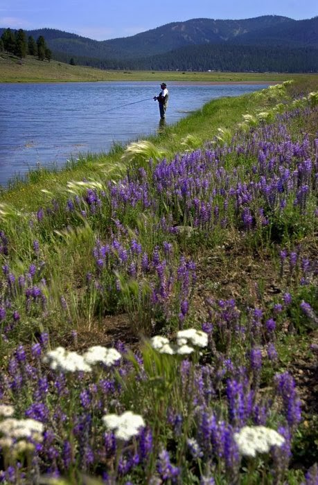
Texas Bluebonnets,california:


Lupinus texensis, the Texas bluebonnet, is a species of lupine endemic to Texas. With other related species of lupines also called bluebonnets, it is the state flower of Texas.It is a biennial plant which begins its life as a small, gravel-like seed. The seed has a hard seed coat that must be penetrated by wind, rain, and weather over the course of a few months. In the fall, the bluebonnets emerge as small seedings with two cotyledons, and later a rosette of leaves that are palmately compound with 5-7 leaflets 3-10 cm long, green with a faint white edge and hair. Growth continues over the mild winter months and then in the spring will take off and rapidly grow larger, before sending up a 20-50 cm tall plume of blue flowers. The scent of these blossoms has been diversely described; many people say they give off no scent at all, while a few have described the scent as 'sickly sweet'.It has been found in the wild with isolated mutations in other colors, most notably all-white flowers, pink, and maroon. These mutations have since been selectively bred to produce different color strains that are available commercially.

Source:
Picture:Link:
Wikipedeia:Link:
Read More 0 comments

Monday, 30 December 2013


Mirror Lake, Yosemite National Park:


Mirror Lake is a small, seasonal lake located on Tenaya Creek in Yosemite National Park. Situated in Tenaya Canyon directly between North Dome and Half Dome, it is the last remnant of a large glacial lake that once filled most of Yosemite Valley at the end of the last Ice Age, and is close to disappearing due to sediment accumulation.


Source:
Picture:Link:
Wikipedeia:Link:
Read More 0 comments

Thursday, 21 November 2013


Zuma Beach, California:


Zuma Beach is a county beach located at 30000 Pacific Coast Highway in Malibu, California. One of the largest and most popular beaches in the Los Angeles County, Zuma is known for its long, wide sands and excellent surf. It consistently ranks among the healthiest beaches for clean water conditions in Los Angeles County.Zuma is protected by the Lifeguard unit of the Los Angeles County Fire Department,with 14 lifeguard towers on the sands proper and one of four L.A. County Section Headquarters located at the center of the beach. Like all beaches with good surf, Zuma has its share of rip currents.Visitors are encouraged not to swim or surf in front of the Lifeguard Headquarters between Towers 8 and 9, an area particularly prone to rip currents. In fact, rip currents are so prevalent that as of 2007 the Los Angeles County Fire Department Lifeguard Unit uses Zuma Beach to illustrate a rip current.Zuma Beach hosts several premier surfing events each year. With optimum wind conditions nearly daily in the late afternoon, Zuma draws many to kitesurfing on the northern end of Zuma Beach.Zuma Beach can be accessed directly from PCH, and lies between the major access corridors Las Virgenes/Malibu Canyon Road and Kanan-Dume Road to the south, and Las Posas Road to the north. Parking is available in a large fee parking lot. Additional parking is available on the adjacent PCH.On its southwest side, Zuma is bordered by Westward Beach. Westward is geographically situated on Malibu's westernmost promontory known as Point Dume. Westward includes a stretch of 2-way road right at the sand's edge. Parking is available on the road as well as a fee parking lot. Westward Beach is marked by a shorter sand shelf than Zuma, a veritable pipeline, making the waves of less duration and higher impact. Westward Beach is recommended only for strong swimmers, as the wave action compared to Zuma Beach is stronger, can push down on swimmers, and delivers more of a "crunch." Westward Beach is where former lifeguard Jesse Billauer suffered the accident that left him paralyzed.During emergency conditions, e.g., fire, mudslide, earthquake, Zuma Beach is the designated emergency evacuation center for evacuees. With its flat terrain, open parking lot, miles of pristine sand, and xeriscape landscaping, it serves as an optimal first response open air shelter.Zuma Beach also sports a dedicated helicopter landing area for medical emergency airlifts to local trauma centers.With its proximity to the film and television industry in Los Angeles, Zuma Beach has been a popular filming location. It was a frequently used site for the television series Baywatch as well as numerous films, television episodes, and advertisements. The beach substitutes for "a deserted island in the south pacific" when Larry Hagman discovers Barbara Eden in the very first episode of the classic sitcom I Dream of Jeannie. The beach is referenced in the 1978 TV-movie Zuma Beach starring Suzanne Somers. Westward Beach has been used for innumerable films, television shows, and advertisements for decades. Planet of the Apes's famous final scene was filmed near here. Countless advertisements, both film and print, that require beach scenes are shots of Westward Beach.Zuma Beach is home to the annual Malibu Nautica Triathlon,a benefit for Children's Hospital of LA. The swim portion begins at Zuma Beach, followed by a bicycle segment along the length of Zuma Beach north to Deer Creek Canyon, capped by a run along the sidewalk fronting Zuma Beach. In its 34th year as of 2008, the Malibu Nautica draws competitors from around the world but is best known in popular culture for the Hollywood celebrities and retired Olympic medalists who compete. Stars in recent Nauticas are Matthew McConaughey, Jennifer Lopez, William Macy, Felicity Huffman, Carl Lewis, and David Duchovny. Many television stars also compete. In 2008, athletes participating in the Nautica raised nearly $980,000 for Children's Hospital.


Source:
Picture:Link:
Wikipedeia:Link:
Read More 0 comments

Wednesday, 20 November 2013


Mammoth Lakes, California:


Mammoth Lakes is a town in Mono County, California, the county's only incorporated community. It is located 9 miles.The population was 8,234 at the 2010 census, up from 7,093 at the 2000 census.According to the United States Census Bureau, the town has a total area of 25.3 square miles, of which 24.9 sq mi are land, and 0.4 sq mi water.Mammoth Lakes resides on the edge of the Long Valley Caldera. The area around the town is geologically active, with hot springs and rhyolite domes that are less than 1000 years old.Visitors can take State Route 203 from the town of Mammoth Lakes to the Mammoth Mountain Ski Area, over Minaret Summit, then down to Devils Postpile National Monument, with access to the Ansel Adams Wilderness.The area has natural hot springs which are sometimes used after skiing. Other features include lakes, a soda springs, and an obsidian dome. Mammoth Lakes is north of the Owens Valley, a scenic area with extensive hiking opportunities.The town is surrounded by mountains: on the west, Mammoth Mountain looms over the town, while to the south, the Sherwin Range dominates the view. This hilly terrain and the high altitude makes the area great for high-altitude athletic training.The European history of Mammoth Lakes started in 1877, when four prospectors staked a claim on Mineral Hill, south of the current town, along Old Mammoth Road. In 1878, the Mammoth Mining Company was organized to mine Mineral Hill, which caused a gold rush. By the end of 1878, 1500 people settled in the mining camp called Mammoth City. By 1880, the company had shut down, and by 1888, the population declined to less than 10 people. By the early 1900s, the town of Mammoth was informally established near Mammoth Creek. The economics of the original town was based on logging and tourism.The first post office at Mammoth Lakes opened in 1923.In 2004, the Mammoth Ski Museum opened in town. The museum featured many vintage artifacts, photographs, and posters. A movie documenting the life of the founder of the ski resort and those of early famous skiers in the area is shown. In 2010, photographs taken by Dave McCoy were featured in an exhibit at the museum.Due to its high altitude, Mammoth Lakes has become popular among elite long-distance runners, who live and train in the thin air.The 2010 United States Census reported that Mammoth Lakes had a population of 8,234. The population density was 325.4 people per square mile. The racial makeup of Mammoth Lakes was 6,643 White, 29 African American, 49 Native American, 128 Asian, 5 Pacific Islander, 1,151 from other races, and 229 from two or more races. Hispanic or Latino of any race were 2,772 persons.The Census reported that 8,076 people lived in households, 158 lived in non-institutionalized group quarters, and 0 were institutionalized.
There were 3,229 households, out of which 942 had children under the age of 18 living in them, 1,401 were opposite-sex married couples living together, 177 had a female householder with no husband present, 144 had a male householder with no wife present. There were 293 unmarried opposite-sex partnerships, and 13 same-sex married couples or partnerships. 899 households were made up of individuals and 153 had someone living alone who was 65 years of age or older. The average household size was 2.50. There were 1,722 families; the average family size was 3.14.There were 9,626 housing units at an average density of 380.4 per square mile, of which 1,502 were owner-occupied, and 1,727 were occupied by renters. The homeowner vacancy rate was 3.4%; the rental vacancy rate was 33.6%. 3,464 people lived in owner-occupied housing units and 4,612 people lived in rental housing units.


Source:
Picture:Link:
Wikipedeia:Link:
Read More 0 comments

Sunday, 10 November 2013


Newport Beach, California:


Newport Beach, incorporated in 1906, is an affluent city in Orange County, California, 10 miles south of downtown Santa Ana. The population was 85,287 at the 2010 census. Newport Beach is also home to Newport Harbor.The city's median family income and property values consistently place high in national rankings. The Daily Pilot, a newspaper published in the neighboring city of Costa Mesa but which serves the greater Newport-Mesa community, reported in 2010 that more than a quarter of households have an income greater than $200,000, and the median value for homes exceeds $1 million.The Upper Bay of Newport is a canyon, which was carved by steam in the Pleistocene period. The lower bay of Newport was formed much later by sand, brought along by ocean currents, constructed the offshore beach, now recognized as the Balboa Peninsula of Newport Beach. Before settlers reached the coasts of California, the Newport area and surrounding areas were very prominent Indian lands. Indian shells and relics can still be found today scattered throughout the area. Though, throughout the 1800s, settlers began to settle the area due to the availability of land. The State of California sold acre-plots of land for $1 a piece in the Newport area. Anglo-American civilization in Newport grew substantially when in 1870 a 105-ton steamer named The Vaquero, captained by Captain Samuel S. Dunnells, against warnings posted by surveyors, safely steered through the lower and upper bay of Newport where it unloaded its cargo. James Irvine, after hearing the astonishing news, quickly traveled from his home in San Francisco to the San Joaquin Ranch. Meeting in Irvine's ranch house near current day UC Irvine with his brother, Robert Irvine, and friend James McFadden, they all agreed that the newly found port should be named simply, "Newport" thus where Newport Beach gets its name.In 1905 city development increased when Pacific Electric Railway established a southern terminus in Newport connecting the beach with downtown Los Angeles. In 1906 with a population of 206 citizens, the scattered settlements were incorporated as the City of Newport Beach.Settlements filled in on the Peninsula, West Newport, Newport Island, Balboa Island and Lido Isle. In 1923 Corona del Mar was annexed and in 2002 Newport Coast, East Santa Ana Heights and San Joaquin Hills, were annexed.In 2008, after a long battle with the city of Costa Mesa, Newport Beach annexed West Santa Ana Heights.Newport Beach extends in elevation from sea level to the 1161 ft. summit of Signal Peak in the San Joaquin Hills,but the official elevation is 25 feet.The city is bordered on the west by Huntington Beach at the Santa Ana River; on the north by Costa Mesa, John Wayne Airport, the City of Irvine and UC Irvine; and on the east by Crystal Cove State Park.According to the United States Census Bureau, the city has a total area of 53.0 square miles. 23.8 square miles (62 km2) of it is land and 29.2 square miles of it is water.Areas of Newport Beach include Corona del Mar, Balboa Island, Balboa Peninsula, Lido Peninsula, Newport Coast, San Joaquin Hills, and Santa Ana Heights, and West Newport.Newport Harbor is a semi-artificial harbor that was formed by dredging Newport Bay estuary during the early 1900s. Several artificial islands were built, which are now covered with private homes: Newport Island, Balboa Island, Little Balboa Island, Collins Island, Bay Island, Harbor Island, Lido Isle and Linda Isle.Newport Harbor once supported maritime industries such as boatbuilding, shipbuilding, and commercial fishing, but today it is used mostly for recreation. Its shores are occupied mostly by private homes and private docks. With approximately 9,000 boats, Newport Harbor is one of the largest recreational boat harbors on the U.S. west coast. It's a popular destination for all boating activities, including sailing, fishing, rowing, canoeing, kayaking, and paddleboarding.

Source:
Picture:Link:
Wikipedeia:Link:
Read More 0 comments

Monday, 14 October 2013


Kings Canyon National Park is a national park in the southern Sierra Nevada, east of Fresno, California. The park was established in 1940 and covers 461,901 acres.It incorporated General Grant National Park, established in 1890 to protect the General Grant Grove of giant sequoias.Kings Canyon had been known to white settlers since the mid-19th century, but it was not until John Muir first visited in 1873 that the canyon began receiving attention. Muir was delighted at the canyon's similarity to Yosemite Valley, as it reinforced his theory regarding the origin of both valleys, which, though competing with Josiah Whitney's then-accepted theory that the spectacular mountain valleys were formed by earthquake action, Muir's theory later proved correct: that both valleys were carved by massive glaciers during the last Ice Age.
Then United States Secretary of the Interior Harold Ickes fought to create the Kings Canyon National Park. He hired Ansel Adams to photograph and document this among other parks, in great part leading to the passage of the bill in March 1940. The bill combined the General Grant Grove with the backcountry beyond Zumwalt Meadow.
Kings Canyon's future was in doubt for nearly fifty years. Some wanted to build a dam at the western end of the valley, while others wanted to preserve it as a park. The debate was settled in 1965, when the valley, along with Tehipite Valley, was added to the park.Kings Canyon National Park consists of two sections. The small, detached General Grant Grove section preserves several groves of giant sequoias, including the General Grant Grove, with the famous General Grant Tree, and the Redwood Mountain Grove, which is the largest remaining natural grove of giant sequoias in the world (covering 3,100 acres (1,300 ha) and with 15,800 sequoia trees over one foot 1 foot in diameter at their bases). The park's Giant Sequoia forests are part of 202,430 acres (81,920 ha) of old-growth forests shared by Sequoia and Kings Canyon National Parks. This section of the park is mostly mixed conifer forest, and is readily accessible via paved highways.
The remainder of Kings Canyon National Park, which comprises over 90% of the total area of the park, is located to the east of General Grant Grove and forms the headwaters of the South and Middle Forks of the Kings River and the South Fork of the San Joaquin River. Both the South and Middle Forks of the Kings Rivers have extensive glacial canyons. One portion of the South Fork canyon, known as the Kings Canyon, gives the entire park its name. Kings Canyon, with a maximum depth of 8,200 feet, is one of the deepest canyons in the United States.The canyon was carved by glaciers out of granite. The Kings Canyon, and its developed area, Cedar Grove, is the only portion of the main part of the park that is accessible by motor vehicle. Both the Kings Canyon and its Middle Fork twin, Tehipite Valley, are deeply incised, U-shaped glacial gorges with relatively flat floors and towering granite cliffs thousands of feet high. In addition, the canyon has several cave systems, one of which is the Boyden Cave, which is open to the public.
To the east of the canyons are the high peaks of the Sierra Crest, which attain an elevation of 14,248 feet NAVD 88 at the summit of North Palisade, the highest point in the park.This is classic high Sierra country: barren alpine ridges and glacially scoured lake-filled basins. Usually snow free only from late June until late October, the high country is accessible only via foot and horse trails. The Sierran crest forms the eastern boundary of the park, from Mount Goethe in the north, down to Junction Peak, at the boundary with Sequoia National Park. Several passes cross the crest into the park, including Bishop Pass, Taboose Pass, Sawmill Pass, and Kearsarge Pass. All of these passes are above 11,000 feet elevation.

Source:
Picture:Link:
Wikipedia:Link:
Read More 0 comments


Kings Canyon National Park is a national park in the southern Sierra Nevada, east of Fresno, California. The park was established in 1940 and covers 461,901 acres.It incorporated General Grant National Park, established in 1890 to protect the General Grant Grove of giant sequoias.Kings Canyon had been known to white settlers since the mid-19th century, but it was not until John Muir first visited in 1873 that the canyon began receiving attention. Muir was delighted at the canyon's similarity to Yosemite Valley, as it reinforced his theory regarding the origin of both valleys, which, though competing with Josiah Whitney's then-accepted theory that the spectacular mountain valleys were formed by earthquake action, Muir's theory later proved correct: that both valleys were carved by massive glaciers during the last Ice Age.
Then United States Secretary of the Interior Harold Ickes fought to create the Kings Canyon National Park. He hired Ansel Adams to photograph and document this among other parks, in great part leading to the passage of the bill in March 1940. The bill combined the General Grant Grove with the backcountry beyond Zumwalt Meadow.
Kings Canyon's future was in doubt for nearly fifty years. Some wanted to build a dam at the western end of the valley, while others wanted to preserve it as a park. The debate was settled in 1965, when the valley, along with Tehipite Valley, was added to the park.Kings Canyon National Park consists of two sections. The small, detached General Grant Grove section preserves several groves of giant sequoias, including the General Grant Grove, with the famous General Grant Tree, and the Redwood Mountain Grove, which is the largest remaining natural grove of giant sequoias in the world (covering 3,100 acres (1,300 ha) and with 15,800 sequoia trees over one foot 1 foot in diameter at their bases). The park's Giant Sequoia forests are part of 202,430 acres (81,920 ha) of old-growth forests shared by Sequoia and Kings Canyon National Parks. This section of the park is mostly mixed conifer forest, and is readily accessible via paved highways.
The remainder of Kings Canyon National Park, which comprises over 90% of the total area of the park, is located to the east of General Grant Grove and forms the headwaters of the South and Middle Forks of the Kings River and the South Fork of the San Joaquin River. Both the South and Middle Forks of the Kings Rivers have extensive glacial canyons. One portion of the South Fork canyon, known as the Kings Canyon, gives the entire park its name. Kings Canyon, with a maximum depth of 8,200 feet, is one of the deepest canyons in the United States.The canyon was carved by glaciers out of granite. The Kings Canyon, and its developed area, Cedar Grove, is the only portion of the main part of the park that is accessible by motor vehicle. Both the Kings Canyon and its Middle Fork twin, Tehipite Valley, are deeply incised, U-shaped glacial gorges with relatively flat floors and towering granite cliffs thousands of feet high. In addition, the canyon has several cave systems, one of which is the Boyden Cave, which is open to the public.
To the east of the canyons are the high peaks of the Sierra Crest, which attain an elevation of 14,248 feet NAVD 88 at the summit of North Palisade, the highest point in the park.This is classic high Sierra country: barren alpine ridges and glacially scoured lake-filled basins. Usually snow free only from late June until late October, the high country is accessible only via foot and horse trails. The Sierran crest forms the eastern boundary of the park, from Mount Goethe in the north, down to Junction Peak, at the boundary with Sequoia National Park. Several passes cross the crest into the park, including Bishop Pass, Taboose Pass, Sawmill Pass, and Kearsarge Pass. All of these passes are above 11,000 feet elevation.

Source:
Picture:Link:
Wikipedia:Link:

Read More 0 comments