Showing posts with label Pakistan:. Show all posts

Thursday, 13 February 2014


Satpara Lake, Skardu, Gilgit-Baltistan, Pakistan:


Satpara Lake is a natural lake near Skardu, Gilgit-Baltistan, Pakistan, which supplies water to Skardu Valley. It is fed by the Satpara Stream.Satpara Lake is situated at an elevation of 2,636 meters (8,650 ft) above sea level and is spread over an area of 2.5 km².The completion of Satpara Dam downstream of the lake has enlarged the size of Satpara Lake.


Source:
Picture | Link:
Wikipedia | Link:
Read More 0 comments

Thursday, 2 January 2014

 Shangrila, Skardu, Pakistan:


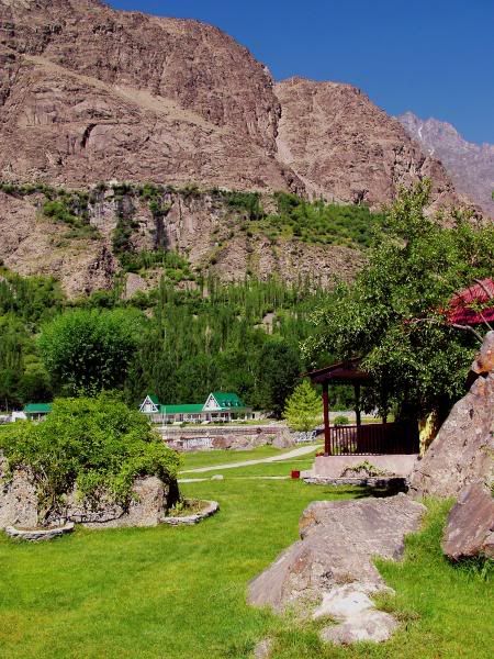
Shangrila Lake or Lower Kachura Lake is a part of the Shangrila resort located at a drive of about 20 minutes from Skardu town.It is a popular tourist destination, and has a unique restaurant that is built on the fuselage of an aircraft that had crashed nearby.Shangrila was established in 1983 with the opening of the first Resort Hotel in Skardu, Baltistan. Shangrila Resort Hotel was founded by the late Brig.Muhammad Aslam Khan, the first commander of the Northern Scouts of the Pakistan Army.Shangrila was named after a book titled "Lost Horizon" by James Hilton. In the novel, the author narrates a tale in which an aeroplane crash landed near a riverbed, in the early 1920s. The surviving passengers came across some Buddhist monks from a nearby temple and sought their help. They were taken to a beautiful lamasery filled with a variety of fruits and flowers. The monks looked quite young, although they claimed to be hundreds of years old. The idyllic place was called Shangri-la, a Tibetan word meaning "Heaven on earth".

Source:
Picture:Link:
Wikipedeia:Link:
Read More 0 comments


Laila Peak, Central Karakoram National Park


Laila Peak in Hushe Valley near Gondogoro Glacier is in Karakoram range and is 6,096 metres high. It has a distinctive spear-like shape. Its northwest face has a slope of 45 degrees in more than 1500 vertical metres.It has been climbed by Simon Yates, among others. According to the local people in Hushe, Laila peak has been climbed only twice, a total of only seven people have summited.It was climbed in winter for the first time by Spanish mountaineers Alex Txikon and José Fernandez, in February 2013.The height of the Laila peak in Hushe Valley is controversial. Some believe it to be 6200 metres whereas some mention it as 6614 metres. In a Japanese mountaineering map by Tsuneo Miyamori, the height of Laila Peak is mentioned as 6096 metres.In the summer of 2005, the first ever ski attempts on Laila Peak were made by Fredrik Ericsson and Jörgen Aamot from Scandinavian countries. Although they could not reach the summit, they skied down the North-West face of the peak. They described it as "one of the most amazing mountains they have ever seen, like a needle it points straight up in the sky".Frederik and Jörgen reached the base camp of Laila Peak on June 18, 2005, and they were at Camp1 on June 22. They made their first attempt to summit on Friday, June 24. They started climbing from 5000 metres at 2:30 am and after seven hours of climbing when they were only 100 metres from the summit, they realized that it was too icy to continue, and started skiing down on the North-West face of Laila Peak towards Gondogoro Glacier.The second group ever to attempt to ski the mountain was Paul Holding, Brendan O'Sullivan, Ed Blanchard Wrigglesworth and Luca Pandolfi. All were the first snowboarders on the mountain except for Ed Blanchard Wrigglesworth, who was on skis. They reached the col at 5,400m only to find that the whole left side of the face had avalanched down to rock while they were climbing from the south side, scuppering any attempts for that year. A full account of their story can be found here.

Source:
Picture:Link:
Wikipedeia:Link:
Read More 0 comments

Saturday, 14 December 2013


Attabad Lake, Hunza,Pakistan:


The lake was formed due to a massive landslide at Attabad village in Gilgit-Baltistan, 9 miles upstream of Karimabad that occurred on January 4, 2010.The landslide killed twenty people and blocked the flow of the Hunza River for five months. The lake flooding has displaced 6,000 people from upstream villages, stranded a further 25,000,and inundated over 12 miles of the Karakoram Highway.The lake reached 13 miles long and over 100 metres in depth by the first week of June 2010 when it began flowing over the landslide dam, completely submerging lower Shishkat and partly flooding Gulmit.The subdivision of Gojal has the greatest number of flooded buildings, over 170 houses, and 120 shops. The residents also had shortages of food and other items due to the blockage of the Karakoram Highway.By June 4 water outflow from the lake had increased to 3,700 cu ft/s.Victims of the landslide and expansion of the lake staged a sit-in protesting the lack of government action and compensation payments to them.As a result of the damming of Hunza River, five villages north of the barrier were flooded. One village, Ayeenabad, was completely submerged. Major portions of another village, Shishkat, was also submerged. Around 40% of the village of Gulmit, which also serves as the headquarter of Gojal Valley, was also submerged. Significant portions of land in Hussain and Ghulkin villages of Gojal also got submerged as a result of the surging lake.

Source:
Picture:Link:
Wikipedeia:Link:
Read More 0 comments

Tuesday, 10 December 2013


Faisal Mosque, Islamabad:


The Faisal Mosque is the largest mosque in Pakistan, located in the national capital city of Islamabad. Completed in 1986, it was designed by Turkish architect Vedat Dalokay to be shaped like a desert Bedouin's tent.It is situated at the north end of Faisal Avenue, putting it at the northernmost end of the city and at the foot of Margalla Hills, the westernmost foothills of the Himalayas. It is located on an elevated area of land against a picturesque backdrop of the Margalla Hills. This enviable location represents the mosque's great importance and allows it to be seen from miles around day and night.The Faisal Mosque is conceived as the National Mosque of Pakistan and named after the late King Faisal bin Abdul-Aziz of Saudi Arabia, who supported and financed the project.The largest mosque in South Asia, the Faisal Mosque was the largest mosque in the world from 1986 until 1993, when it was overtaken in size by the newly completed Hassan II Mosque in Casablanca, Morocco. Subsequent expansions of the Masjid al-Haram in Medina, Saudi Arabia, during the 1990s relegated Faisal Mosque to fourth place in terms of size.The impetus for the mosque began in 1966 when the late King Faisal bin Abdul-Aziz supported the initiative of the Pakistani Government to build a national mosque in Islamabad during an official visit to Pakistan.In 1969, an international competition was held in which architects from 17 countries submitted 43 proposals. The mosque was designed by Turkish architect Vedat Dalokay. Construction of the mosque began in 1976 by National Construction of Pakistan, led by Azim Khan and was funded by the government of Saudi Arabia, at a cost of over 130 million Saudi riyals. King Faisal bin Abdul Aziz was instrumental in the funding, and both the mosque and the road leading to it were named after him after his assassination in 1975. The mosque was completed in 1986, and used to house the International Islamic University.Many conservative Muslims criticised the design at first for its unconventional design and lack of a traditional dome structure, but most criticism ended when the completed mosque's scale, form, and setting against the Margalla Hills became evident.


Source:
Picture:Link:
Wikipedeia:Link:
Read More 0 comments

Friday, 22 November 2013


Beauty of Chitral, Pakistan:


Chitral, translated as field in the native language Khowar, is the capital of the Chitral District, situated on the western bank of the Kunar River, in Khyber Pakhtunkhwa, Pakistan. It also served as the capital of the former princely state of Chitral.The town is at the foot of Tirich Mir, the highest peak of the Hindu Kush, which is 25,289 ft high. It has a population of 20,000. The altitude of the valley is 3,700 ft.The Chitral Town, is situated on the west bank of the Chitral at the foot of Tirich Mir which at 7,708 m is the highest peak of the Hindu Kush. Up until 1969, it served as the capital of the princely state of Chitral.The easiest access to Chitral, other than by air, is in the southwest along the Kunar Valley from Jalalabad. This route is open all year and provides direct access to Kabul. However the Pakistan–Afghanistan border prevents this from being used as an internal route to the south. The other routes are over high mountain passes. To the south, the 3,200 metres Lowari Pass leads 365 kilometres to Peshawar. In the north, the easiest route during summer runs over the 3,798 metres Broghol Pass to Afghanistan's Wakhan Corridor. To the east, there is a 405 kilometres route to Gilgit over the 3,719 metres Shandur Pass. In the west, the 4,300 metres Dorah Pass provides an additional route to Afghanistan. The territory is cut off by snow from the rest of the country for up to six months a year, a problem soon to be relieved by the completion of the Lowari Tunnel.Nothing definitive is recorded about the area’s first settlers. In the 3rd century AD, Kanishka, the Buddhist ruler of the Kushan empire, occupied Chitral. In the 4th century AD, the Chinese overran the valley. Raees rule over Chitral began in 1320 and came to an end in the 15th century. From 1571 onwards Chitral Town was the capital of the princely state of Chitral under the rule of the Katur Dynasty.In contrast to more southerly valleys of Khyber Pakhtunkhwa, Chitral has a dry Mediterranean climate with almost no rainfall during summers. Precipitation occurs mainly from spring thunderstorms brought about by western frontal systems. In the winter the night time temperature occasionally drops to −10 C. Winter snowfall in the town can be quite heavy with an accumulation of up to two feet being quite common, at higher elevations snowfall can reach as high as 20 metres .The general population is mainly of the Kho people, who speak the Khowar language, which is also spoken in parts of Yasin, Gilgit and Swat.The Norwegian linguist Georg Morgenstierne wrote that Chitral is the area of the greatest linguistic diversity in the world. Although Khowar is the predominant language of Chitral, more than ten other languages are spoken here.

Source:
Picture:Link:
Wikipedeia:Link:
Read More 0 comments

Wednesday, 2 October 2013

K2 mountain in Gilgit-Baltistan, Pakistan
 K2 (also known as Chhogori/Qogir, Ketu/Kechu, and Mount Godwin-Austen) is the second-highest mountain on Earth, after Mount Everest. It is located on the border between Baltistan, in the Gilgit–Baltistan region of northern Pakistan, and the Taxkorgan Tajik Autonomous County of Xinjiang, China.With a peak elevation of 8,611 m (28,251 feet), K2 is the highest point of the Karakoram Range and the highest point in Pakistan.
K2 is known as the Savage Mountain due to the extreme difficulty of ascent and the second-highest fatality rate among the eight thousanders. For every four people who have reached the summit, one has died trying. It is more hazardous to reach K2 from the Chinese side; thus, it is mostly climbed from the Pakistani side. Unlike Annapurna, the mountain with the highest fatality-to-summit rate, K2 has never been climbed in winter

Source:
Picture:Link:
WikipediaLink::
Read More 0 comments

Tuesday, 24 September 2013

                                Nanga Parbat


Nanga Parbat is the ninth highest mountain in the world. It is the western anchor of the Himalayas around which the Indus river skirts before it debouches into the plains of Pakistan. It is located in the Gilgit-Baltistan region of Pakistan.
Nanga Parbat is one of the eight-thousanders, with a summit elevation of 8,126 metres (26,660 ft). An immense, dramatic peak rising far above its surrounding terrain, Nanga Parbat is also a notoriously difficult climb. Numerous mountaineering deaths in the mid and early 20th century lent it the nickname "killer mountain". Along with K2, it has never been climbed in winter
The core of Nanga Parbat is a long ridge trending southwest–northeast. The ridge is an enormous bulk of ice and rock. It has three faces, Diamir face, Rakhiot and Rupal. The southwestern portion of this main ridge is known as the Mazeno Wall, and has a number of subsidiary peaks. In the other direction, the main ridge arcs northeast at Rakhiot Peak (7,070 m / 23,196 ft). The south/southeast side of the mountain is dominated by the massive Rupal Face, noted above. The north/northwest side of the mountain, leading to the Indus, is more complex. It is split into the Diamir (west) face and the Rakhiot (north) face by a long ridge. There are a number of subsidiary summits, including North Peak (7,816 m / 25,643 ft) some 3 km north of the main summit. Near the base of the Rupal Face is a beautiful glacial lake called Latbo, above a seasonal shepherds' village of the same name.

source:
picture:Link:
Wikipedia:Link:

Read More 0 comments

Sunday, 22 September 2013


K2  is the second-highest mountain on Earth, after Mount Everest. It is located on the border between Baltistan, in the Gilgit–Baltistan region of northern Pakistan, and the Taxkorgan Tajik Autonomous County of Xinjiang, China. With a peak elevation of 8,611 m (28,251 feet), K2 is the highest point of the Karakoram Range and the highest point in Pakistan.K2 is known as the Savage Mountain due to the extreme difficulty of ascent and the second-highest fatality rate among the eight thousanders. For every four people who have reached the summit, one has died trying. It is more hazardous to reach K2 from the Chinese side; thus, it is mostly climbed from the Pakistani side. Unlike Annapurna, the mountain with the highest fatality-to-summit rate, K2 has never been climbed in winter.

The name K2 is derived from the notation used by the Great Trigonometric Survey. Thomas Montgomerie made the first survey of the Karakoram from Mount Haramukh, some 210 km (130 miles) to the south, and sketched the two most prominent peaks, labelling them K1 and K2.The policy of the Great Trigonometric Survey was to use local names for mountains wherever possible and K1 was found to be known locally as Masherbrum. K2, however, appeared not to have acquired a local name, possibly due to its remoteness. The mountain is not visible from Askole, the last village to the south, or from the nearest habitation to the north, and is only fleetingly glimpsed from the end of the Baltoro Glacier, beyond which few local people would have ventured. The name Chogori, derived from two Balti words, chhogo ("big") and ri ("mountain") (شاہگوری) has been suggested as a local name, but evidence for its widespread use is scant. It may have been a compound name invented by Western explorers or simply a bemused reply to the question "What's that called?" It does, however, form the basis for the name Qogir  by which Chinese authorities officially refer to the peak. Other local names have been suggested including Lamba Pahar ("Tall Mountain" in Urdu) and Dapsang, but are not widely use


Source:
Picture: Link:
Wikipedia: Link:
Read More 0 comments