Showing posts with label Greece. Show all posts

Tuesday, 25 March 2014


Mykonos Island, Greece:


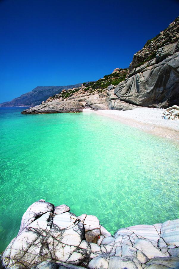
Myrtos Beach is in the region of Pylaros, in the north-west of Kefalonia island, in the Ionian Sea of Greece. Myrtos beach lies between the feet of two mountains, Agia Dynati and Kalon Oros.The surrounding sediment at Myrtos Beach is generally made up of marble material, a metamorphosed limestone. The beach is made up of round, white cobblestones. The sediment gradually becomes smaller as you approach the shoreline. Because the slope angle has an abrupt drop near the edge of the shoreline, the wave energy is very high and causes the gradation trends from cobbles to pebbles along the beach.Longshore drift, along with wave energy, has shaped the shore. As waves curve along the beach they also pick up the finest bits of marble; this creates sediment plumes that follow the curve of the beach with the direction of the waves giving the water a shade of turquoise.[3]A steep, winding road, about 2 km in length and with hairpin turns, leads down to the beach from the village of Divarata.During the high tourist-season in the summer, the Municipality of Pylaros runs a public bus service to and from Myrtos Beach, departing from the harbour area in Agia Efimia. Timetables can be found at the Tourist Information office in Agia Efimia and may also be listed online. The bus stops on the road leading down to the beach, with a brief walk down. Private-car parking is available at the base of the cliffs.There are several tavernas at the top of the road leading down to the beach in the village of Divarata, and a beach bar.


Source:
Picture:Link:
Wikipedia:Link:
Read More 0 comments

Friday, 7 March 2014

Loggas Beach, Corfu Island, Greece:


Corfu is a Greek island in the Ionian Sea. It is the second largest of the Ionian Islands,and, including its small satellite islands, forms the edge of the northwestern frontier of Greece.The island is part of the Corfu regional unit, and is administered as a single municipality. The municipality includes the island Corfu and the smaller islands Ereikoussa, Mathraki and Othonoi. The principal city of the island and seat of the municipality is also named Corfu.Corfu is home to the Ionian University.The island is bound with the history of Greece from the beginning of Greek mythology. Its Greek name, Kerkyra or Korkyra, is related to two powerful water symbols: Poseidon, god of the sea, and Asopos, an important Greek mainland river.According to myth, Poseidon fell in love with the beautiful nymph Korkyra, daughter of Asopus and river nymph Metope, and abducted her.Poseidon brought Korkyra to the hitherto unnamed island and, in marital bliss, offered her name to the place: Korkyra,which gradually evolved to Kerkyra.Together, they had a child they called Phaiax, after whom the inhabitants of the island were named: Phaiakes. This term was transliterated via Latin to Phaeacians. Corfu's nickname is The island of the Phaeacians.The island's history is laden with battles and conquests. The legacy of these struggles is visible in the form of castles punctuating strategic locations across the island. Two of these castles enclose its capital, which is the only city in Greece to be surrounded in such a way. As a result, Corfu's capital has been officially declared a Kastropolis by the Greek government.From medieval times and into the 17th century, the island was recognised as a bulwark of the European States against the Ottoman Empire and became one of the most fortified places in Europe.The fortifications of the island were used by the Venetians to defend against Ottoman intrusion into the Adriatic. Corfu repulsed several Turkish sieges, before falling under British rule following the Napoleonic Wars. Corfu was eventually ceded by the British Empire along with the remaining islands of the United States of the Ionian Islands, and unification with modern Greece was concluded in 1864 under the Treaty of London.In 2007, the city's old city was designated for the UNESCO World Heritage List, following a recommendation by ICOMOS.


Source:
Picture:Link:
Wikipedeia:Link:
Read More 0 comments

Friday, 28 February 2014


Kerkyra, Ionian Islands, Greece:


The Ionian Islands are a group of islands in Greece. They are traditionally called the Heptanese, i.e. "the Seven Islands" , but the group includes many smaller islands as well as the seven principal ones.The Ionian Islands official region, excluding Cythera, in 2011 was 207,855, decreased by 1,50% compared to the population in 2001. Nevertheless, the region remains the third by population density with 90.1/km² nation-wide, well above the national of 81.96/km². The most populous of the major islands is Corfu with a population of 104,371, followed by Zante , Cephalonia , Leucas and Ithaca.The foreign-born population was in 2001 19,360 or 9.3%, the majority of which was concentrated in Corfu and Zante. Most of them originate from Albania.The fertility rate for 2011 according to Eurostat was 1.35 live births per woman.The regional Gross Domestic Product for 2010 was 4,029 millions euros. The GDP per capita for the same year was 18,440 euros per capita which was lower than the national median of 20,481. However, the GDP per capita of Cephalonia and Zante, 23,275 and 24,616 respectively, was much higher than the national figure.[6] Additionally, unemployment for 2012 was 14.7, the lowest among all Greek regions, and much lower compared to the national unemployment of 24.2.


Source:
Picture:Link:
Wikipedeia:Link:
Read More 0 comments


Lefkada Island, Greece:


Lefkada, or Leucas or Leucadia or Lefkas or Leukas, is a Greek island in the Ionian Sea on the west coast of Greece, connected to the mainland by a long causeway and floating bridge. The principal town of the island and seat of the municipality is Lefkada.It is situated on the northern part of the island, approximately 20 minutes by automobile away from Aktion National Airport. The island is part of the regional unit of Lefkada.The myth about Sappho's suicide at Cape Lefkada is related to other myths linking the island to the ancient Greek goddess of love, Aphrodite, and to Odysseus, the hero of Homer's Odyssey. The German archaeologist Wilhelm Dörpfeld, having performed excavations at various locations of Lefkada, was able to obtain funding to do work on the island by suggesting that Lefkada was Homer's Ithaca, and the palace of Odysseus was located west of Nydri on the south coast of Lefkada. There have been suggestions by local tourism officials that several passages in the Odyssey point to Lefkada as a possible model for Homeric Ithaca. The most notable of these passages pushed by the local tourism board describes Ithaca as an island reachable on foot, which was the case for Lefkada since it is not really an island, that it was connected to the mainland by a narrow causeway. According to Strabo, the coast of Acarnania was called Leucas in earlier times. The ancient sources call Leucas a Corinthian colony, perhaps with a Corcyraen participation.During the Peloponnesian War Leucas had joined the Spartan Confederation.O Fotinós, is a famous unfinished poem relating the so-called Voukentra revolution of 1357 in Lefkada against the Venetian occupation by islander Aristotelis Valoritis.The Ottomans called it "Ayamavra", and ruled it between 1479–1502, 1504–1684 and 1715-1716.Lefkada measures 35 kilometres from north to south, and 15 kilometres from east to west. Its area is 336 square kilometres. Its highest point is the mountain Stavrota, 1,158 metres above sea level,[8] situated in the middle of the island. The east coast section of the island has small resorts of Lygia, Nikiana and Perigiali, all north of Nidri, the largest resort on the island. It is set in a sheltered location with views across to Skorpios—formerly owned by Aristotle Onassis, Meganissi and other small islands, as well as the Greek mainland. The main coastal road from Lefkada to Vasiliki runs through the village, although a bypass has now been completed which skirts the village to the west. There are regular car ferries to Kefalonia, Ithaca and Meganissi.20 kilometres south of Nidri is the resort of Vasiliki, a windsurfing center. There are ferries to Kefalonia and Ithaca from Vasiliki. South of Vasiliki is Cape Lefkada, where the Greek female poet Sappho allegedly leapt to her death from the 30 m high cliffs.The famous beach of Porto Katsiki is located on Lefkada's west coast. Lefkada was attached to mainland Greece. The Corinthians dug a trench in the 7th century BC on its isthmus.

Source:
Picture:Link:
Wikipedeia:Link:
Read More 0 comments

Friday, 21 February 2014


A panoramic view of the Acropolis and Monastiraki plazain, Athens, Greece:


Athens is the capital and largest city of Greece. Athens dominates the Attica region and is one of the world's oldest cities, with its recorded history spanning around 3,400 years. Classical Athens, as a landlocked location was a powerful city-state that emerged in conjunction with the seagoing development of the port of Piraeus. A centre for the arts, learning and philosophy, home of Plato's Academy and Aristotle's Lyceum,it is widely referred to as the cradle of Western civilization and the birthplace of democracy,largely due to the impact of its cultural and political achievements during the 5th and 4th centuries BC in later centuries on the rest of the then known European continent.Today a cosmopolitan metropolis, modern Athens is central to economic, financial, industrial, political and cultural life in Greece. In 2012, Athens was ranked the world's 39th richest city by purchasing power and the 77th most expensive in a UBS study.The city of Athens has a population of 664,046 within its administrative limits and a land area of 39 km2.The urban area of Athens extends beyond the administrative municipal city limits, with a population of 3,074,160,over an area of 412 km2.According to Eurostat, the Athens Larger Urban Zone is the 7th most populous LUZ in the European Union, with a population of 4,013,368. Athens is also the southernmost capital on the European mainland.The heritage of the classical era is still evident in the city, represented by ancient monuments and works of art, the most famous of all being the Parthenon, considered a key landmark of early Western civilization. The city also retains Roman and Byzantine monuments, as well as a smaller number of Ottoman monuments.

Source:
Picture:Link:
Wikipedeia:Link:

Read More 0 comments

Tuesday, 18 February 2014


Ocean Balcony, Santorini, Greece:


Santorini, classically Thera /ˈθɪrə/, and officially Thira is an island in the southern Aegean Sea, about 200 km southeast of Greece's mainland. It is the largest island of a small, circular archipelago which bears the same name and is the remnant of a volcanic caldera. It forms the southernmost member of the Cyclades group of islands, with an area of approximately 73 km2 and a 2011 census population of 15,550. The municipality of Santorini comprises the inhabited islands of Santorini and Therasia and the uninhabited islands of Nea Kameni, Palaia Kameni, Aspronisi, and Christiana. The total land area is 90.623 km2 . Santorini is part of the Thira regional unit.Santorini is essentially what remains after an enormous volcanic explosion that destroyed the earliest settlements on a formerly single island, and created the current geological caldera. A giant central, rectangular lagoon, which measures about 12 by 7 km, is surrounded by 300 m high, steep cliffs on three sides. The main island slopes downward to the Aegean Sea. On the fourth side, the lagoon is separated from the sea by another much smaller island called Therasia; the lagoon is connected to the sea in two places, in the northwest and southwest. The depth of the caldera, at 400m, makes it possible for all but the largest ships to anchor anywhere in the protected bay; there is also a newly built marina at Vlychada, on the southwestern coast. The island's principal port is Athinias. The capital, Fira, clings to the top of the cliff looking down on the lagoon. The volcanic rocks present from the prior eruptions feature olivine and have a small presence of hornblende.


Source:
Picture:Link:
Wikipedeia:Link:
Read More 0 comments

Saturday, 15 February 2014


Assos, Kefalonia Island, Greece:


Cephalonia or Kefalonia, formerly also known as Kefallinia or Kephallenia is the largest of the Ionian Islands in western Greece. It is also a separate regional unit of the Ionian Islands region, and the only municipality of the regional unit. The capital of Cephalonia is Argostoli.The size of the island is about 781 km2, and the present population density is 55 people per km2. The town of Argostoli has one-third of the island's inhabitants. Lixouri is the second major settlement, and the two towns together account for almost two-thirds of the prefecture's population.Cephalonia is in the heart of an earthquake zone, and dozens of minor or unrecorded tremors occur each year. In 1953, a massive earthquake almost destroyed all settlement on the island, leaving only Fiscardo in the north untouched.Among important natural features are the Melissani Lake, the Drogarati caves, and the Koutavos Lagoon in Argostoli.The island has a rich biodiversity, with a substantial number of endemic and rare species. Parts of it have been declared a "Natura Site" in the European Union’s NATURA 2000.


Source:
Picture:Link:
Wikipedeia:Link:
Read More 0 comments

Tuesday, 11 February 2014


Ancient Konitsa Bridge, Epirus ,Greece:


Epirus , formally the Epirus Region , is a geographical and administrative region in northwestern Greece. It borders the regions of West Macedonia and Thessaly to the east, West Greece to the south, the Ionian Sea and the Ionian Islands to the west and the country of Albania to the north. The region has an area of about 9,200 km2 (3,600 sq mi). It is part of the wider historical region of Epirus, which overlaps modern Albania and Greece but mostly lies in modern Greek territory.Greek Epirus, like the region as a whole, is rugged and mountainous.It comprises the land of the ancient Molossians and Thesprotians and a small part of the land of the Chaonians the greater part being in Southern Albania. It is largely made up of mountainous ridges, part of the Dinaric Alps. The region's highest spot is on Mount Smolikas, at an altitude of 2.637 metres above sea level. In the east, the Pindus Mountains that form the spine of mainland Greece separate Epirus from Macedonia and Thessaly. Most of Epirus lies on the windward side of the Pindus. The winds from the Ionian Sea offer the region more rainfall than any other part of Greece.The Vikos-Aoos and Pindus National Parks are situated in the Ioannina Prefecture of the region. Both areas have imposing landscapes of dazzling beauty as well as a wide range of fauna and flora. The climate of Epirus is mainly alpine. The vegetation is made up mainly of coniferous species. The animal life is especially rich in this area and includes, among other species, bears, wolves, foxes, deer and lynxes.


Source:
Picture | Link:
Wikipedia | Link:
Read More 0 comments

Friday, 7 February 2014


La Grotta Cove, Corfu Island, Greece:


Corfu is a Greek island in the Ionian Sea. It is the second largest of the Ionian Islands and, including its small satellite islands, forms the edge of the northwestern frontier of Greece.The island is part of the Corfu regional unit, and is administered as a single municipality. The municipality includes the island Corfu and the smaller islands Ereikoussa, Mathraki and Othonoi. The principal city of the island and seat of the municipality is also named Corfu.Corfu is home to the Ionian University.The island is bound with the history of Greece from the beginning of Greek mythology. Its Greek name, Kerkyra or Korkyra, is related to two powerful water symbols: Poseidon, god of the sea, and Asopos, an important Greek mainland river.According to myth, Poseidon fell in love with the beautiful nymph Korkyra, daughter of Asopus and river nymph Metope, and abducted her.Poseidon brought Korkyra to the hitherto unnamed island and, in marital bliss, offered her name to the place: Korkyra,which gradually evolved to Kerkyra.Together, they had a child they called Phaiax, after whom the inhabitants of the island were named: Phaiakes. This term was transliterated via Latin to Phaeacians. Corfu's nickname is The island of the Phaeacians.The island's history is laden with battles and conquests. The legacy of these struggles is visible in the form of castles punctuating strategic locations across the island. Two of these castles enclose its capital, which is the only city in Greece to be surrounded in such a way. As a result, Corfu's capital has been officially declared a Kastropolis by the Greek government.From medieval times and into the 17th century, the island was recognised as a bulwark of the European States against the Ottoman Empire and became one of the most fortified places in Europe.The fortifications of the island were used by the Venetians to defend against Ottoman intrusion into the Adriatic. Corfu repulsed several Turkish sieges, before falling under British rule following the Napoleonic Wars. Corfu was eventually ceded by the British Empire along with the remaining islands of the United States of the Ionian Islands, and unification with modern Greece was concluded in 1864 under the Treaty of London.In 2007, the city's old city was designated for the UNESCO World Heritage List, following a recommendation by ICOMOS.


Source:
Picture:Link:
Wikipedeia:Link:
Read More 0 comments

Wednesday, 5 February 2014


Medieval streets, Rhodes, Greece:


Rhodes is the principal city and a former municipality on the island of Rhodes an island in the Dodecanese, Greece. Since the 2011 local government reform it is part of the municipality Rhodes, of which it is the seat and a municipal unit.It has a population of approximately 100,000. Rhodes has been famous since antiquity as the site of Colossus of Rhodes, one of the Seven Wonders of the World. The Colossus has been used in many poems, the most famous being Shakespeare's Julius Caesar. The citadel of Rhodes, built by the Hospitalliers, is one of the best-preserved medieval towns in Europe, which in 1988 was designated as a UNESCO World Heritage Site. The city of Rhodes is a popular international tourist destination.The city of Rhodes is situated in the north-east tip of the island and forms a triangle from north to south. It is the smallest municipality of the island in terms of land area and the largest in population. It borders the Aegean Sea to the north, the east and the west and with the municipalities of Ialysos and Kallithea in the south.The island of Rhodes is at a crossroads between Europe, the Middle East, and Africa. This has given the city and the island many different identities, cultures, architectures, and languages over its long history. Its position in major sea routes has given Rhodes a very rich history. The island has been inhabited since about 4000 BC.The city of Rhodes was formed by the cities of Ialyssos, Kamiros and Lindos in 408 BC,and prospered for three centuries during its Golden Age, when sea trade, skilled shipbuilders, and open-minded politicians of the city kept it prosperous until Roman times. The Colossus of Rhodes, one of the original Seven Wonders of the Ancient World was built by the Lindian sculptor Chares between 304 and 293 BC,which took 12 years and was completed in 282 BC. The statue represented their sun god Helios, which stood at the harbour entrance. The ancient city had a well-constructed sewage system as well as a water supply network as designed by Hippodamus. A strong earthquake hit Rhodes about 226 BC, badly damaging the city and toppling the Colossus.For the next eight centuries it lay in ruins until it was sold to a Jewish merchant, reputed to require 900 camels to haul it away.


Source:
Picture:Link:
Wikipedeia:Link:
Read More 0 comments

Sunday, 26 January 2014

Mykonos Harbour, Greece:


Mykonos is a popular tourist destination in the Greek islands of the Cyclades group, situated in the middle of the Aegean Sea. Mykonos is located south of Tinos, east of Syros and north of Paros and Naxos.Mykonos is famed as a cosmopolitan destination amongst the Greek islands and widely recognised as one of the great travel meccas. It is one of the most touristed islands in the Aegean. This means that visitors should be prepared for loud dance clubs on parts of the island, an option to have 'English' breakfasts that could consist of an egg, some bacon and a few rolls with butter, and some over-priced merchandise. Mykonos, along with Santorini, is more expensive than other Greek islands.If you have a room in the centre of town, expect to be woken by people going about their business in the early hours of the morning - this could be people arriving back from a nights clubbing or local bakers who arrive very early for work every day of the week. Although a lot of the streets in the main town are closed to traffic, locals get around on mopeds/motorbikes and on other motorised contraptions, and once again, they make quite a lot of noise in the early hours of the morning if they go past your open window. If you don't have a room that offers air conditioning and you are planning to keep your windows open at night, some ear-plugs might be an idea if you are a light sleeper.

Source:
Picture:Link:
Wikipedeia:Link:
Read More 0 comments

Tuesday, 21 January 2014


Narrow Street, Paros Island, Greece:


Paros is a Greek island in the Cyclades group, neighbouring Naxos and is one of the most popular holiday destinations for visitors to the Greek islands.Paros is the second largest island of the Cyclades. It has an area of 196 square kilometres and a coastline 120km long. The island has the advantage of being located centrally in the Cyclades near Naxos, Ios, Sifnos and Syros. Most of the ferries to Naxos and Santorini make a stop first at Paros.The island is the third in popularity of the group. First are Santorini and Mykonos.Paros is considered as one of the most beautiful islands of the Cyclades. It is characterized by the many beaches and also the charming villages: Parikia, Naoussa, Lefkes, Marpissa and other. Naoussa is an old fishing village turned into a cosmopolitan top holiday destination. The village is characterized by its Venetian port and its many fish restaurants. The architecture of the area is also incredible.Don't miss the church of Panagia Ekatontapiliani which means the church of 100 doors , in Parikia a 4th century monument, rebuilt after the earthquake of 1773. The original church was built by St. Helen , the mother of St. Constantine, according to the legend . The old town of Parikia is considered to be the biggest in the Cyclades island. You will find alleys untouched from the touristic wave that reduces the beauty of these settlements. Lefkes village is in the middle of the island with many nice tavernas, and beautiful alleys. From Lefkes you can take a very nice walk at the old stones of the Byzantine Route down to Prodromos.

Source:
Picture:Link:
Wikipedeia:Link:
Read More 0 comments

Monday, 13 January 2014


Santorini, Greece.


Santorini, classically Thera, and officially Thira; is an island in the southern Aegean Sea, about 200 km southeast of Greece's mainland. It is the largest island of a small, circular archipelago which bears the same name and is the remnant of a volcanic caldera. It forms the southernmost member of the Cyclades group of islands, with an area of approximately 73 km2 and a 2011 census population of 15,550. The municipality of Santorini comprises the inhabited islands of Santorini and Therasia and the uninhabited islands of Nea Kameni, Palaia Kameni, Aspronisi, and Christiana. The total land area is 90.623 km2. Santorini is part of the Thira regional unit.Santorini is essentially what remains after an enormous volcanic explosion that destroyed the earliest settlements on a formerly single island, and created the current geological caldera. A giant central, rectangular lagoon, which measures about 12 by 7 km, is surrounded by 300 m high, steep cliffs on three sides. The main island slopes downward to the Aegean Sea. On the fourth side, the lagoon is separated from the sea by another much smaller island called Therasia; the lagoon is connected to the sea in two places, in the northwest and southwest. The depth of the caldera, at 400m, makes it possible for all but the largest ships to anchor anywhere in the protected bay; there is also a newly built marina at Vlychada, on the southwestern coast. The island's principal port is Athinias. The capital, Fira, clings to the top of the cliff looking down on the lagoon. The volcanic rocks present from the prior eruptions feature olivine and have a small presence of hornblende.It is the most active volcanic centre in the South Aegean Volcanic Arc, though what remains today is chiefly a water-filled caldera. The volcanic arc is approximately 500 km long and 20 to 40 km wide. The region first became volcanically active around 3–4 million years ago, though volcanism on Thera began around 2 million years ago with the extrusion of dacitic lavas from vents around the Akrotiri.The island is the site of one of the largest volcanic eruptions in recorded history: the Minoan eruption, which occurred some 3600 years ago at the height of the Minoan civilization. The eruption left a large caldera surrounded by volcanic ash deposits hundreds of metres deep and may have led indirectly to the collapse of the Minoan civilization on the island of Crete, 110 km to the south, through a gigantic tsunami. Another popular theory holds that the Thera eruption is the source of the legend of Atlantis.

Source:
Picture:Link:
Wikipedeia:Link:
Read More 0 comments

Tuesday, 7 January 2014


Melissani Lake, Greece


Melissani Cave or Melissani Lake, also Melisani is a cave located on the island of Kefalonia, northwest of Sami, about 5 km SE of Agia Efthymia, NE of Argostoli and NW of Poros. The Ionian Sea lies to the east with the Strait of Ithaca. Forests surrounds the cave and the mountain slope is to the west. Near the cave is the entry to the cave with parking lots and is passed almost in the middle of the main road linking Sami and Agia Efimia especially to the northern part of the island.In Greek mythology, Melissani was the cave of the nymphs. The cave features a lake that are surrounded with trees and forests. The cave is located east of the mountains of Evmorfia and Agia Dynati. Tourism is common in the cave.The cave features a sky-blue lake covered with stones at the bottom. Plants are at the door of the cave. The color of the rocks which are stucco to honey-like brown is at the door of the cave. The lake is also inside the cave.The cave was rediscovered in 1951 by Giannis Petrocheilos.

Source:
Picture:Link:
Wikipedeia:Link:
Read More 0 comments

Saturday, 28 December 2013


Ikaria, Greece:


Icaria, also spelled Ikaria, is a Greek island in the Aegean Sea, 10 nautical miles southwest of Samos. It derived its name from Icarus, the son of Daedalus in Greek mythology, who fell into the sea nearby. Administratively the island forms a separate municipality within the Ikaria regional unit, which is part of the North Aegean region. The principal town of the island and seat of the municipality is Agios Kirykos.The historic capitals of the island include Oenoe and Evdilos.Icaria has been inhabited since at least 7000 BC, when it was populated by the Neolithic pre-Hellenic people that Greeks called Pelasgians. Around 750 BC, Greeks from Miletus colonized Icaria, establishing a settlement in the area of present day Campos, which they called Oenoe for its wine.Icaria, in the 6th century BC, became part of Polycrates' sea empire, and, in the 5th century BC, the Icarian cities of Oenoe and Thermae were members of the Athenian-dominated Delian League. In the 2nd century, the island was colonized by Samos.At this time, the Tauropolion,the temple of Artemis was built at Oenoe. Coins of the city represented Artemis and a bull.There was another, smaller temenos that was sacred to Artemis Tauropolos,at Nas, on the northwest coast of the island.Nas had been a sacred spot to the pre-Greek inhabitants of the Aegean and an important island port in antiquity, the last stop before testing the dangerous seas around Icaria. It was an appropriate place for sailors to make sacrifices to Artemis Tauropolos, who, among other functions, was a patron of seafarers; here, the goddess was represented in an archaic wooden xoanon.

Source:
Picture:Link:
Wikipedeia:Link:
Read More 0 comments


Koufonisia, Greece:


Koufonisia is a former community in the Cyclades, Greece. Since the 2011 local government reform it is part of the municipality Naxos and Lesser Cyclades, of which it is a municipal unit.It consists of three main islands.There are two versions, as far as the name of the island is concerned. According to the first one, Koufonisia was the ancient name of the gulf which is between Koufonisia and Glaronisi. As a matter of fact, the full name was "Koufos Limin", which means lee port, where ships can anchor.According to the second version, which is supported by Manesis, this name was chosen because of the large number of caves and sediments without boisterous rocks that are found on the island. Anthony Miliarakis, in contrast with these two theories, wrote in his book in 1920 that Pano Koufonisi was known as "Fakousa" and Kato Koufonisi as "Pino".According to archaeological findings, Koufonisia were inhabited since prehistoric times. Excavations in Epano Mili brought to light important findings that date back to the first years of Cycladic civilization. One of the most important findings from this period is a fryer-shaped vessel with a nine-ray star on it, exhibited in Naxos' museum. Excavations on the east shore brought to light findings of the Hellenistic and Roman times.In the course of history, Koufonisia followed the fate of the rest of Cyclades islands. They were dominated by the Venetians and the Turks, who, mostly in the 17th century, fought about the governance of the Aegean Sea. Residents of Koufonisia, either because they needed to or because they wanted to, often joined their forces with the residents of Mani or with other pirates, who were using the channel between Pano and Kato Koufonisi as a safe shelter. Koufonisia were set free along with the rest of Cyclades islands and incorporated into the Greek state in 1830.During occupancy, the islands' residents faced difficult times. In the postbellum period, the island had 1000 inhabitants. However, many of them migrated to Athens in order to find a job and many men left the islands to work as grummets. Residents were going to the other Greek islands and the mainland by small boats and by a ship that was going to Heraclia every eight days. During those years, there was only one doctor in Small Cyclades and when the weather was bad, he could not travel to Koufonisia.

Source:
Picture:Link:
Wikipedeia:Link:
Read More 0 comments

Wednesday, 18 December 2013


Balos Bay - Gramvousa, Crete,Greece:


Gramvousa also Grampousa refers to two small uninhabited islands off the coast of north-western Crete in the regional unit of Chania.They are administered from the municipality of Kissamos.Imeri Gramvousa, which translates to Tame Gramvousa, hosts the remains of a Venetian fort and the remains of buildings left behind by Cretan insurgents, who were compelled to live as pirates, during the Greek War of Independence. Today, Imeri Gramvousa is a popular tourist attraction.Agria Gramvousa, which translates to Wild Gramvousa, is much less hospitable and is located due north of Imeri Gramvousa.The fort at Imeri Gramvousa was built in 1579 during Venetian rule over Crete to defend the island from the Ottoman Turks. The fort remained in Venetian hands throughout the prolonged Cretan War, and in the treaty of 16 September 1669, which surrendered Crete to the Ottomans, Gramvousa, along with the fortresses of Souda and Spinalonga, was retained by Venice.These three forts defended Venetian trade routes and were also strategic bases in the event of a new Ottoman-Venetian war for Crete.On 6 December 1691, during the Morean War, the Neapolitan Captain de la Giocca betrayed the Venetians by surrendering Gramvousa to the Ottoman Turks for a generous bribe. He lived the rest of his life in Constantinople and was well known by the nickname "Captain Grambousas".Not long after the start of Turkish rule, Cretan insurgents used to gather at the three coastal forts which included Gramvousa.

Source:
Picture:Link:
Wikipedeia:Link:
Read More 0 comments

Monday, 21 October 2013

Molyvos, Lesvos Greece:


Mithymna is a former municipality on the island of Lesbos, North Aegean, Greece. Since the 2011 local government reform it is part of the municipality Lesbos, of which it is a municipal unit.The second most important town of the island, it is located NE of Eressos, N of Plomari and NW of Mytilene.The town is on the northern part of the island, just some 6 km north of the popular beach town of Petra. One of the most noticeable features of the town is the old Genoese fortress on the hill in the middle of the town.The municipal unit of Míthymna stretches eastward from the town along the northern part of the island; it is the island's smallest municipal unit in land area at 50.166 km². Its population was 2,433 at the 2001 census. The next largest towns in the municipal unit are Árgennos and Sykaminéa.As Methymna, the city was once the prosperous second city of Lesbos, with a founding myth that identified an eponymous Methymna, the daughter of Macar and married to the personification of Lesbos.Very little is known about Methymna in the Archaic period. The story of Arion and the dolphin, which involves the Corinthian tyrant Periander and is evidently set at the turn of the 7th century BCE, suggests that Methymna was already a prominent city with far-reaching contacts across the Greek world at this period.Herodotus tells us that at some point in the Archaic period, Methymna enslaved the city of Arisba on Lesbos: this will have greatly increased the territory of Methymna, as well as giving it access to the fertile land around the Gulf of Kalloni.We are also told by a local historian, Myrsilus of Methymna, who wrote in the first half of the 3rd century BCE, that Methymna founded the city of Assos which was on the coast of Asia Minor opposite Methymna.However, another local historian, Hellanicus of Mytilene, writing in the mid-5th century BCE, instead simply says Assos was an Aeolian foundation and does not specify a particular city as its founder.This has led some historians to doubt Myrsilus, and instead suggest that this is an example of "local Methymnaean manipulation of the past", although this could equally be true of Hellanicus.Methymna had a long-standing rivalry with Mytilene, and during the Peloponnesian War it sided with Athens during the Mytilenaean revolt in 428 BCE when all the other cities of Lesbos sided with Mytilene.When the Athenians put down the revolt the following year, only Methymna was spared from having its territory turned into a cleruchy.After 427, Methymna and Chios were the only members of the Delian League to remain self-governing and exempt from tribute, indicating the privileged position Methymna held within the Athenian Empire.Methymna was briefly captured by the Spartans in summer 412, before quickly being retaken by the Athenians: in describing this episode, the historian Thucydides indicates that the Methymnaeans were much more inclined to side with Athens than Sparta.This was likewise the case in 411, when a group of Methymnaeans who were in exile at Cyme in Aeolis attempted to return to Methymna by force, but were rebuffed by the population.When the Spartan commander Kallikratidas besieged Methymna in 406, the city stayed loyal to its Athenian garrison and held out until it was betrayed by several traitors.Our knowledge of the history of Methymna in the 4th century is limited, but its prominence as a polis is firmly attested by the city's silver and bronze coinage.[14] By at least the 340s BCE, the tyrant Kleommis had expelled the city's democrats and remained in power for the next decade.We do not know what happened to Kleommis after this, although it is likely that he was expelled when the island fell to Philip II's generals Parmenio and Attalus in 336.[16] The political history of the following four years are poorly attested: we know that Lesbos changed hands several times between the Macedonian forces of Alexander the Great and the Persian forces of Memnon of Rhodes, that Memnon captured Methymna in 333 BCE, and that when Alexander's admiral Hegelochus recaptured Methymna in 332 BCE its tyrant was Aristonicus not Kleommis.However, it is not clear whether Aristonicus was made tyrant when the Persians recaptured Methymna in 335, or whether Kleommis was re-installed and Aristonicus only made tyrant in 333. Whatever the case, in 332 Alexander gave Aristonicus over to the newly restored Methymnaean democracy to try, and he was found guilty and put to death by torture

Source:
Picture:Link:
Wikipedia:Link:
Read More 0 comments


santorini, greece.:


Santorini, is an island in the southern Aegean Sea, about 200 km southeast from Greece's mainland. It is the largest island of a small, circular archipelago which bears the same name and is the remnant of a volcanic caldera. It forms the southernmost member of the Cyclades group of islands, with an area of approximately 73 km2 and a 2011 census population of 15,550. The municipality of Santorini comprises the inhabited islands of Santorini and Therasia and the uninhabited islands of Nea Kameni, Palaia Kameni, Aspronisi, and Christiana. The total land area is 90.623 km2. Santorini is part of the Thira regional unit.Santorini is essentially what remains after an enormous volcanic explosion that destroyed the earliest settlements on a formerly single island, and created the current geological caldera. A giant central, rectangular lagoon, which measures about 12 by 7 km, is surrounded by 300 m high, steep cliffs on three sides. The main island slopes downward to the Aegean Sea. On the fourth side, the lagoon is separated from the sea by another much smaller island called Therasia; the lagoon is connected to the sea in two places, in the northwest and southwest. The depth of the caldera, at 400m, makes it possible for all but the largest ships to anchor anywhere in the protected bay; there is also a newly built marina at Vlychada, on the southwestern coast. The island's principal port is Athinias. The capital, Fira, clings to the top of the cliff looking down on the lagoon. The volcanic rocks present from the prior eruptions feature olivine and have a small presence of hornblende.It is the most active volcanic centre in the South Aegean Volcanic Arc, though what remains today is chiefly a water-filled caldera. The volcanic arc is approximately 500 km (310 mi) long and 20 to 40 km wide. The region first became volcanically active around 3–4 million years ago, though volcanism on Thera began around 2 million years ago with the extrusion of dacitic lavas from vents around the Akrotiri.The island is the site of one of the largest volcanic eruptions in recorded history: the Minoan eruption, which occurred some 3600 years ago at the height of the Minoan civilization. The eruption left a large caldera surrounded by volcanic ash deposits hundreds of metres deep and may have led indirectly to the collapse of the Minoan civilization on the island of Crete, 110 km  to the south, through a gigantic tsunami. Another popular theory holds that the Thera eruption is the source of the legend of Atlantis.Excavations starting in 1967 at the site called Akrotiri under the late Professor Spyridon Marinatos have made Thera the best-known Minoan site outside of Crete, the homeland of the culture. The island was not known as Thera at this time. Only the southern tip of a large town has been uncovered, yet it has revealed complexes of multi-level buildings, streets, and squares with remains of walls standing as high as eight metres, all entombed in the solidified ash of the famous eruption of Thera. The site was not a palace-complex such as are found in Crete, but its excellent masonry and fine wall-paintings show that this was certainly no conglomeration of merchants' warehousing either. A loom-workshop suggests organized textile weaving for export. This Bronze Age civilization thrived between 3000 to 2000 BC, and reached its peak in the period 2000 to 1580 BC.
Some of the houses in Akrotiri are major structures, some amongst them three storeys high. Its streets, squares, and walls were preserved in the layers of ejecta, sometimes as tall as eight metres, and indicating this was a major town. In many houses stone staircases are still intact, and they contain huge ceramic storage jars, mills, and pottery. Noted archaeological remains found in Akrotiri are wall paintings or frescoes, which have kept their original colour well, as they were preserved under many metres of volcanic ash. The town also had a highly developed drainage system and, judging from the fine artwork, its citizens were clearly sophisticated and relatively wealthy people.Pipes with running water and water closets found at Akrotiri are the oldest such utilities discovered[citation needed]. The pipes run in twin systems, indicating that the Therans used both hot and cold water supplies; the origin of the hot water probably was geothermic, given the volcano's proximity. The dual pipe system, the advanced architecture, and the apparent layout of the Akrotiri find resemble Plato's description of the legendary lost city of Atlantis, further indicating the Minoans as the culture which primarily inspired the Atlantis legend.Fragmentary wall-paintings at Akrotiri lack the insistent religious or mythological content familiar in Classical Greek décor. Instead, the Minoan frescoes depict "Saffron-Gatherers", who offer their crocus-stamens to a seated lady, perhaps a goddess. Crocus has been discovered to have many medicinal values including the relief of menstrual pain. This has led many[who?] archaeologists to believe that the fresco of the saffron/crocus gatherers is a coming of age fresco dealing with female pubescence. In another house are two antelopes, painted with a kind of confident, flowing, decorative, calligraphic line, the famous fresco of a fisherman with his double strings of fish strung by their gills, and the flotilla of pleasure boats, accompanied by leaping dolphins, where ladies take their ease in the shade of light canopies, among other frescoes.The well preserved ruins of the ancient town often are compared to the spectacular ruins at Pompeii in Italy. The canopy covering the ruins collapsed in an accident in September 2005, killing one tourist and injuring seven more. The site was closed for almost seven years while a new canopy was built. The site was re-opened in April 2012.The oldest signs of human settlement are Late Neolithic, but ca. 2000–1650 BC Akrotiri developed into one of the Aegean's major Bronze Age ports, with recovered objects that had come, not just from Crete, but also from Anatolia, Cyprus, Syria, and Egypt as well as from the Dodecanese and the Greek mainland.

Source:
Picture:Link:
Wikipedia:Link:
Read More 0 comments

Saturday, 19 October 2013


Zakynthos Island, Greece:


Zakynthos or Zante is a Greek island in the Ionian Sea. It is the third largest of the Ionian Islands. Zakynthos is a separate regional unit of the Ionian Islands region, and its only municipality. It covers an area of 410 km2 and its coastline is roughly 123 km (76 mi) in length. The island is named after Zakynthos, the son of a legendary Arcadian chief Dardanus. The name, like all similar names ending in -nthos, is pre-Mycenaean or Pelasgian in origin.Zakynthos is a tourist destination, and has clubs and bars, and hosts events including The Rum and Raybands Boat Party, Total Karnage and The White Party. The island's nickname is To fioro tou Levante, given by the Venetians.Zakynthos was inhabited from the Neolithic Age, as some archaeological excavations have proved.The famous ancient Greek poet and writer, Homer, first mentioned the island in his masterpieces, the Iliad and the Odyssey, stating that the first inhabitants of it were the son of King Dardanos of Troy called Zakynthos and his men and that they first came on the island around 1500–1600 BC.The island was then conquered by the Great Imperial King Arkeisios of Kefalonia. The famous Ulysses from Ithaca was the next King to conquer the island.Later on, a treaty was signed that made Zakynthos an independent democracy, the first established in the Hell area, that lasted more than 650 years.The Athenian military commander Tolmides concluded an alliance with Zakynthus during the First Peloponnesian War sometime between 459 and 446 BC.The importance of this alliance for Athens was that it provided them with a source of tar. Tar is a more effective protector of ship planking than pitch. The Athenian trireme fleet needed protection from rot, decay and the teredo, so this new source of tar was valuable to them. The tar was dredged up from the bottom of a lake using leafy myrtle branches tied to the ends of poles. It was then collected in pots and could be carried to the beach and swabbed directly onto ship hulls.Alternatively, the tar could be shipped to the Athenian naval yard at the Piraeus for storage.During the Middle Ages, the island was part of the Byzantine theme of Cephallenia. After 1185 it became part of the County palatine of Cephalonia and Zakynthos under the Kingdom of Naples until its last Count Leonardo III Tocco was defeated by the Ottomans in 1479. The Turkish rule lasted only until 22 April 1484, when it was swapped with the Turks by Venetian secretary Giovanni Dario, negotiator of the treaty of Constantinople, against neighboring Cephalonia and an annual tribute of 500 ducats.From then on Zakynthos remained an overseas colony of the Venetian Republic until its very end in 1797, following the fate of the Ionian islands, completed by the capture of Cephalonia in 1500 and Lefkas in 1684 from the Turks.Venetian rule protected the island from Ottoman domination but in its place it put a feudal oligarchy. The cultural influence of Venice was considerable. The wealthy made a habit of sending their sons to Italy to be educated. Good examples are Dionysios Solomos, a native of Zakynthos and Greece's national poet, and Ugo Foscolo, also native of Zakynthos and a national Italian poet. However, both the Greek language and Orthodox faith survived intact. From the 16th to the 18th centuries, it was one of the largest exporters of currants in the world together with Cephalonia.The Treaty of Campoformio dismantling the Venetian Republic awarded the Ionian Islands to France. General Antoine Gentili, leading a French expeditionary force with boats captured in Venice, took control of the islands on 26 June 1797. From 1797 to 1798, the island was part of the French départment Mer-Égée. A Russian-Turkish fleet captured the island on 23 October 1798. From 1800 to 1807, it was part of the Septinsular Republic, nominally under sovereignty of the Ottoman Empire but protected by Russia. In 1800–1801, Britain attempted to take control of the Ionian islands from Zakynthos after a revolt, under the leadership of James Callander Campbell but these intentions stopped after the Peace of Amiens.After a second period under French control following the treaty of Tilsit, it was conquered by Great Britain on 16 October 1809, and was part of the British protectorate of the United States of the Ionian Islands from 1815 to 1864.

Source:
Picture:Link:
Wikipedia:Link:
Read More 0 comments