Showing posts with label New Zealand.. Show all posts

Tuesday, 11 February 2014


Belfast,New Zealand:


Belfast is a suburb of Christchurch, New Zealand. It is in the north of the city, close to the banks of the Waimakariri River.Belfast is well known for the freezing works, Belfast New World and the Northwood 'Supa Centa', which houses The Warehouse, Countdown, Smiths City and a Subway restaurant, amongst others. In 2006 the Barracutta bar opened alongside these. Belfast is home to the Belfast Cobras rugby team that compete in the Christchurch rugby competition. The team's colours are green and gold. Its main sports ground is Sheldon Park. The northern end of the suburb houses light industry. In recent years the Northwood subdivision was built near Belfast. This is part of Belfast, but is generally agreed to be a subdivision and an autonomous region.


Source:
Picture | Link:
Wikipedia | Link:
Read More 0 comments


Milford Sound, New Zealand:


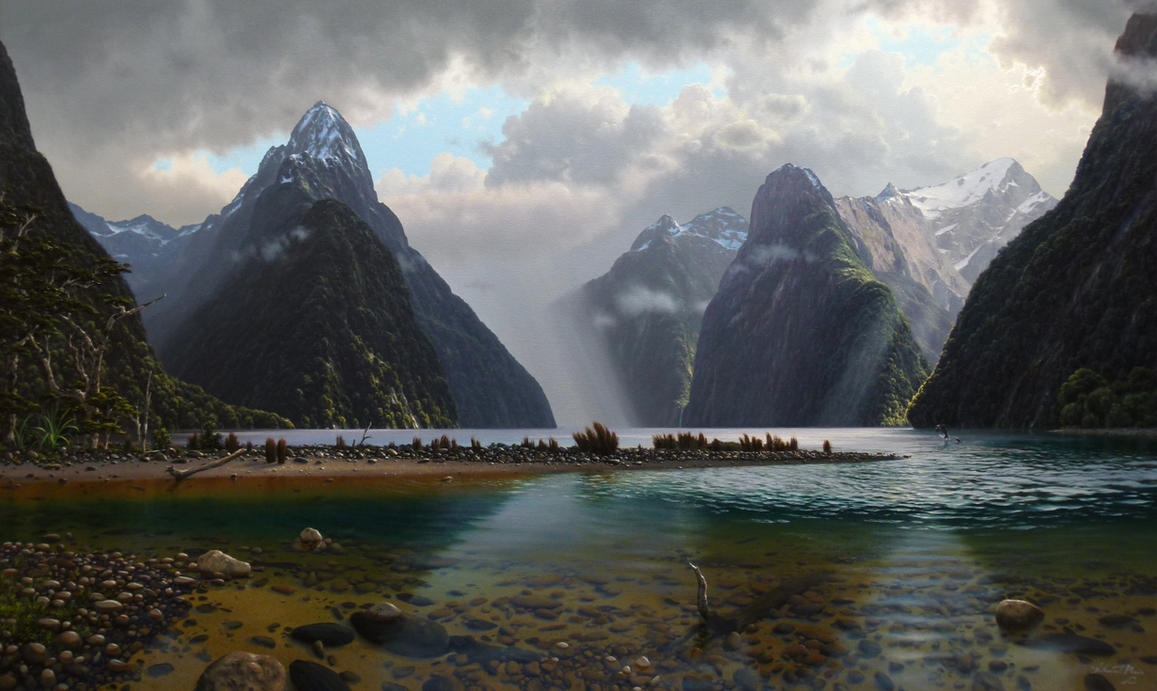
Milford Sound  is a fjord in the south west of New Zealand's South Island, within Fiordland National Park, Piopiotahi (Milford Sound) Marine Reserve, and the Te Wahipounamu World Heritage site. It has been judged the world's top travel destination in an international survey (the 2008 Travelers' Choice Destinations Awards by TripAdvisor) and is acclaimed as New Zealand's most famous tourist destination.Rudyard Kipling had previously called it the eighth Wonder of the World.


Source:
Picture | Link:
Wikipedia | Link:
Read More 0 comments


New Plymouth , New Zealand:


New Plymouth is the major city of the Taranaki Region on the west coast of the North Island of New Zealand. It is named after Plymouth, Devon, England, from where the first English settlers migrated. The New Plymouth District includes New Plymouth City and several smaller towns. The New Plymouth District is the 15th largest district (out of 73) in New Zealand, and has 1.7 percent of New Zealand's population. The district has a population of 74,187 — nearly two thirds of the total population of the Taranaki Region. This includes New Plymouth City (53,400), Waitara (6,483), Inglewood (3,380), Oakura (1,359), Okato (561) and Urenui (429).


Source:
Picture | Link:
Wikipedia Link:
Read More 0 comments


Milford Sounds, New Zealand:


Milford Sound  is a fjord in the south west of New Zealand's South Island, within Fiordland National Park, Piopiotahi  Marine Reserve, and the Te Wahipounamu World Heritage site. It has been judged the world's top travel destination in an international survey (the 2008 Travelers' Choice Destinations Awards by TripAdvisor) and is acclaimed as New Zealand's most famous tourist destination.Rudyard Kipling had previously called it the eighth Wonder of the World


Source:

Picture| Link:
Wikipedia | Link:
Read More 0 comments

Sunday, 2 February 2014


The Glowworm Cave, Waitomo, New Zealand:


The Waitomo Caves are a village and cave system forming a major tourist attraction in the northern King Country region of the North Island of New Zealand, 12 kilometres northwest of Te Kuiti. The community of Waitomo Caves itself is very small, though the village has many temporary service workers living there as well. The word Waitomo comes from the Māori language wai meaning water and tomo meaning a doline or sinkhole; it can thus be translated to be water pasThe limestone landscape of the Waitomo District area has been the centre of increasingly popular commercial caving tourism from as early as 1900. Initially mostly consisting of impromptu trips guided by local Māori, large sections of cave near Waitomo Caves were later taken over by the Crown and managed as a tourism attraction from 1904 onwards.sing through a hole.These Caves are believed to be over two million years old.

Source:
Picture:Link:
Wikipedeia:Link:
Read More 0 comments

Wednesday, 29 January 2014


Fanthams Peak Track , Taranaki, New Zealand:


Taranaki is a region in the west of New Zealand's North Island and is the 10th largest region of New Zealand by population.It is named for the region's main geographical feature, Mount Taranaki.The main centre of the Taranaki region is the city of New Plymouth. The New Plymouth District has over 60% of the entire population of Taranaki.New Plymouth is located in North Taranaki along with Inglewood and Waitara. South Taranaki towns include Hawera, Stratford and Eltham.Since 2005, Taranaki has used the promotional brand "Like no other".The area became home to a number of Māori tribes from the 13th century. From about 1823 the Māori began having contact with European whalers as well as traders who arrived by schooner to buy flax.In March 1828 Richard "Dicky" Barrett set up a trading post at Ngamotu.Barrett and his companions, who were armed with muskets and cannon, were welcomed by the Āti Awa tribe because of their worth assisting in their continuing wars with Waikato Māori.Following a bloody encounter at Ngamotu in 1832, most of the 2000 Āti Awa living near Ngamotu, as well as Barrett, migrated south to the Kapiti region and Marlborough.In late 1839 Barrett returned to Taranaki to act as a purchasing agent for the New Zealand Company, which had already begun on-selling the land to prospective settlers in England with the expectation of securing its title. Barrett claimed to have negotiated the purchase of an area extending from Mokau to Cape Egmont, and inland to the upper reaches of the Whanganui River including Mt Taranaki. A later deed of sale included New Plymouth and all the coastal lands of North Taranaki, including Waitara.

Source:
Picture:Link:
Wikipedeia:Link:
Read More 0 comments

Sunday, 26 January 2014


Swing Bridge, Mount Aspiring National Park, New Zealand:


Mount Aspiring National Park is located in the Southern Alps of the South Island of New Zealand, north of Fiordland National Park, and between Otago and south Westland. The park forms part of the Te Wahipounamu World Heritage site.It was established in 1964 as New Zealand's tenth National Park. The park covers 3,555 km² at the southern end of the Southern Alps, directly to the west of Lake Wanaka, and is popular for tramping, walking and mountaineering. Mount Aspiring / Tititea is the mountain which gives the park its name. Other prominent peaks within the park include Mount Pollux and Mount Brewster.The Haast Pass, one of the three principal road routes across the Southern Alps, is found in the north-eastern corner of the park.In April 2005 the Nature Heritage Fund purchased private land in the Landsborough River valley as an addition to the park.In 2006, the Milford Dart Company asked the Department of Conservation to amend the Mt Aspiring National Park Management Plan to allow an additional road within the park for a bus tunnel, the so-called Milford Tunnel, from the Routeburn Road to the Hollyford Valley to take tourists to Milford Sound.The tunnel would have established a connection via Glenorchy and would have significantly reduced the current return travel time from Queenstown to Milford Sound of 9 hours.In December 2007, the New Zealand Conservation Authority declined to adopt the amendment to the Management Plan. The Conservation Authority considered the proposed road would not add to the use and enjoyment of Mount Aspiring National Park and that the adverse effects of construction and use of the road in the National Park would outweigh any benefits.The proposal gained approval in principle by the Department of Conservation in 2011, but was rejected by the Minister of Conservation, Nick Smith, in July 2013. Smith stated that "the proposal was beyond what was appropriate for a World Heritage Area." The managing director of the company behind the proposal stated that he was "disappointed of course. National trying to out-green the greens. Going skiing.

Source:
Picture:Link:
Wikipedeia:Link:
Read More 0 comments

Friday, 24 January 2014


Moeraki Boulders, Hampden, South Island, New Zealand:


The Moeraki Boulders are unusually large and spherical boulders lying along a stretch of Koekohe Beach on the wave cut Otago coast of New Zealand between Moeraki and Hampden. They occur scattered either as isolated or clusters of boulders within a stretch of beach where they have been protected in a scientific reserve. The erosion by wave action of mudstone, comprising local bedrock and landslides, frequently exposes embedded isolated boulders. These boulders are grey-colored septarian concretions, which have been exhumed from the mudstone enclosing them and concentrated on the beach by coastal erosion.Local Māori legends explained the boulders as the remains of eel baskets, calabashes, and kumara washed ashore from the wreck of Arai-te-uru, a large sailing canoe. This legend tells of the rocky shoals that extend seaward from Shag Point as being the petrified hull of this wreck and a nearby rocky promontory as being the body of the canoe's captain. In 1848 W.B.D. Mantell sketched the beach and its boulders, more numerous than now. The picture is now in the Alexander Turnbull Library in Wellington.The boulders were described in 1850 colonial reports and numerous popular articles since that time. In more recent times they have become a popular tourist attraction, often described and pictured in numerous web pages and tourist guides.As determined by detailed analysis of the fine-grained rock using optical mineralogy, X-ray crystallography, and electron microprobe, the boulders consist of mud, fine silt and clay, cemented by calcite. The degree of cementation varies from being relatively weak within the interior of a boulder to quite hard within its outside rim. The outside rims of the larger boulders consist of as much as 10 to 20% calcite, because the calcite not only tightly cements the silt and clay but has also replaced it to a significant degree.The rock comprising the bulk of a boulder is riddled with large cracks called "septaria" that radiate outward from a hollow core lined with scalenohedral calcite crystals. The process or processes that created septaria within Moeraki Boulders, and in other septarian concretions, remain an unresolved matter for which a number of possible explanations have been proposed. These cracks radiate and thin outward from the centre of the typical boulder and are typically filled with an outer layer of brown calcite and an inner layer of yellow calcite spar, which often, but not always, completely fills the cracks. Rare Moeraki Boulders have a very thin innermost layer of dolomite and quartz covering the yellow calcite spar.

Source:
Picture:Link:
Wikipedeia:Link:
Read More 0 comments

Monday, 13 January 2014


Clutha River, Otago, New Zealand


The Clutha River / Mata-Au is the second longest river in New Zealand flowing south-southeast 338 kilometres through Central and South Otago from Lake Wanaka in the Southern Alps to the Pacific Ocean, 75 kilometres south west of Dunedin. It is the highest volume river in New Zealand, and the swiftest, with a catchment of 21,960 square kilometres, discharging a mean flow of 614 cubic metres per second.The Clutha River is known for its scenery, gold-rush history, and swift turquoise waters. A river conservation group, the Clutha Mata-Au River Parkway Group, is working to establish a regional river parkway, with a trail, along the entire river corridor. The name of the river was changed to a dual name by the Ngai Tahu Claims Settlement Act 1998.The ultimate source of the river is at the head of the Makarora River, close to the saddle of the Haast Pass, which flows into the northern end of Lake Wanaka. The southern end of the lake drains into the nascent Clutha close to Albert Town, where it is met by its first main tributary, the Hāwea River the outflow of Lake Wanaka's twin, Lake Hāwea. It is also met here by the Cardrona River.From here the river flows swiftly through the Upper Clutha Valley between ancient glacial terraces, negotiating a long section called the 'Snake' before reaching a rare switchback feature called the Devil's Nook near the town of Luggate. The river soon narrows as it passes through the Maori Gorge at Queensberry. Shortly thereafter it is joined by another tributary, the Lindis, before widening as it enters Lake Dunstan, an artificial lake created behind the massive hydroelectric dam at Clyde.Fifty kilometres south of Lake Wanaka, the Clutha reaches the town of Cromwell, which was substantially altered when the Clyde Dam project was commissioned in 1992. Here the river is joined by the waters of the Kawarau, which flows from Lake Wakatipu. Prior to the construction of the Clyde Dam, this river junction, known as the Cromwell Junction,was renowned for the difference in colour between the two rivers’ waters.The river then flows southeast through the inundated Cromwell Gorge to Clyde, and nearby Alexandra, where it is joined by the waters of the Manuherikia River. South of Alexandra the river widens again to form Lake Roxburgh, another artificial lake, behind the Roxburgh Dam, which was commissioned in 1956. The hydro reservoir flooded the Roxburgh Gorge and several large rapids including the Molyneux Falls and the Golden Falls. The town of Roxburgh sits close to the river, 120 kilometres downstream from Lake Wanaka.From here the river continues southeast past the towns of Ettrick, Millers Flat, and Beaumont, before flowing through the Rongahere Gorge admired for its native bush corridor and for the Birch Island native reserve. Beyond here, the river is met by the Tuapeka River at Tuapeka Mouth. At this point the river turns southward, before being met by its last major tributary, the Pomahaka River, which joins the Clutha 30 kilometres from the coast. The river passes the town of Balclutha before widening into the Clutha delta which contains the large flat island of Inch Clutha. Here the river divides into two branches, the Matau, which flows past Kaitangata, and Koau. Both branches flow into the Pacific Ocean at Molyneux Bay.The Clutha's average discharge is estimated at 614 cubic metres per second ,comparable to many much larger rivers. This heavy flow, combined with the relatively small size of the river in global terms, makes the Clutha notoriously fast-flowing, and it is often listed as one of the world's most swiftly flowing rivers, alongside Australia's Macleay and Fitzroy Rivers, the Amazon and Atrato Rivers in South America, and the Teesta River in the Himalaya.The waters of the Upper Clutha are clear turquoise, the result of glacial and snow-melt filtering when the water flows through Lake Wanaka. This is a rare characteristic for a high volume river. Below Cromwell, where the silt-laden Kawarau enters, the waters are less turquoise.

Source:
Picture:Link:
Wikipedeia:Link:
Read More 0 comments


The Blue Pools of Haast Pass, South Island, New Zealand:


Haast Pass is a mountain pass in the Southern Alps of the South Island of New Zealand. It is named for Julius von Haast, a 19th century explorer who was also geologist for the Provincial government of Canterbury. The pass was used by Māori in pre-European times, but not on a regular basis.It is one of the three passes where a road crosses over the Southern Alps, the other two being Lewis Pass and Arthur's Pass, although the Homer Tunnel also passes under the Main Divide. The road through Haast Pass was converted from a rough track to a formed road in 1966.and finally received a complete tarmac surface by 1995. In the early 20th century, a railway from the West Coast through the pass to Otago was considered; it would have linked the Ross Branch with the Otago Central Railway, which then terminated in Omakau.However, the line never came to fruition; the Otago Central Railway terminated in Cromwell and no railway was built south of Ross, just a lightly laid bush tramway to serve logging interests near Lake Ianthe.The Haast Pass rises to a height of 562 metres above sea level at the saddle between the valleys of the Haast and Makarora Rivers. As such, it is the lowest of the passes traversing the Southern Alps. The Haast Pass road is devoid of any settlements between Haast and Makarora. The road passes through predominantly unmodified beech forest. The pass itself is within the limits of Mount Aspiring National Park and forms part of the boundary between Otago and the West Coast.


Source:
Picture:Link:
Wikipedeia:Link:
Read More 0 comments

Sunday, 22 December 2013


Milford Sound, New Zealand:


Milford Sound Marine Reserve, and the Te Wahipounamu World Heritage site. It has been judged the world's top travel destination in an international survey and is acclaimed as New Zealand's most famous tourist destination.Rudyard Kipling had previously called it the eighth Wonder of the World.[4Milford Sound is named after Milford Haven in Wales, while the Cleddau River which flows into the sound is also named for its Welsh namesake. The Māori named the sound Piopiotahi after the thrush-like piopio bird, now extinct. Piopiotahi means "a single piopio", harking back to the legend of Māui trying to win immortality for mankind - when Maui died in the attempt, a piopio was said to have flown here in mourning.

Source:
Picture:Link:
Wikipedeia:Link:
Read More 0 comments

Friday, 13 December 2013


Lake Brunner,New Zealand:


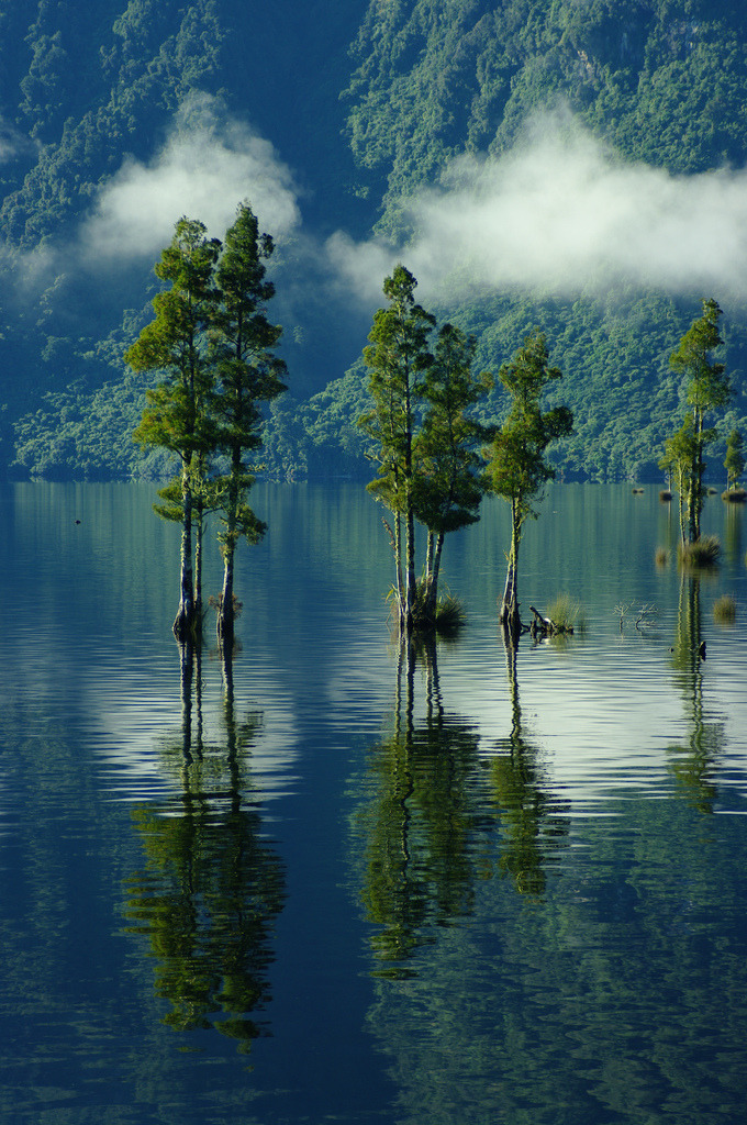
Lake Brunner is the largest lake in the northwestern South Island of New Zealand, covering an area of 40 km². The lake's outflow is the Arnold River, a tributary of the Grey River. The lake lies 31 kilometres to the southeast of Greymouth. The main settlement close to the lake is Moana, on the northern shore.Located several kilometres inland from the coast road, it is less frequently visited by tourists than many of the West Coast's scenic highlights, but it is becoming increasingly popular, in part due to its reputation for fishing.Lake Brunner is named for the 19th century explorer Thomas Brunner and the Maori name for the lake, Kotuku moana, means "Sea of herons".Location of Lake Brunner in the South Island of New Zealand.Location of Lake Brunner in the South Island of New Zealand.The New Zealand freshwater mussel is found in the lake.By 1976 twenty percent of the catchment of the lake was farmed and there was a population of 84 at the settlement of Moana.The waters of Lake Brunner have been monitored since the 1990s and it shows that the water quality of the lake is declining.By 2010 all the measured determinates for water quality were trending up but it was still considered to have good water quality.The poorest water quality is at Cashmere Bay, next to Moana.The West Coast Regional Council 2007 Proposed Water Management Plan is to have the water quality maintained or improved.

Source:
Picture:Link:
Wikipedeia:Link:
Read More 0 comments

Thursday, 28 November 2013


Waiotapu Thermal Reserve, Rotorua, New Zealand:


Wai-O-Tapu is an active geothermal area at the southern end of the Okataina Volcanic Centre, just north of the Reporoa caldera, in New Zealand's Taupo Volcanic Zone. It is 27 kilometres south of Rotorua.The area has many hot springs noted for their colourful appearance, in addition to the Lady Knox Geyser, Champagne Pool, Artist's Palette, Primrose Terrace and boiling mud pools. The geothermal area covers 18 square kilometres.Prior to European occupation the area was the homeland of the Ngati Whaoa tribe who descended from those on the Arawa waka.The area has a long history as a tourist attraction. While the area has been protected as a scenic reserve since 1931, a tourist operation occupies part of the reserve under a concession. It operates under the name "Wai-O-Tapu Thermal Wonderland".The business was bought in 2012 by Te Arawa Group Holdings, a local Maori tribal business, from the Sewell/Leinhardt family, who had run it for 30 years.


Source:
Picture:Link:
Wikipedeia:Link:
Read More 0 comments

Thursday, 14 November 2013


Cathedral Cove Beach, Coromandel Peninsula, New Zealand


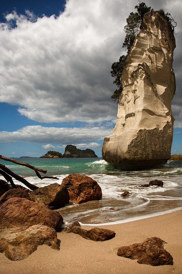
Te Whanganui-A-Hei Marine Reserve is on the Coromandel Peninsula in New Zealand covering an area of 840 hectares.Cathedral Cove is named after the cave located there, linking Mare's Leg Cove to Cathedral Cove. Gemstone Bay and Stingray Bay are also located within the reserve. A walking track exists from the northern end of Hahei Beach, and it is also possible to walk from the local authority car park at the top of the headland between Hahei and Gemstone Bay. The area is very popular with tourists, and receives around 150,000 visitors per year.Boat and kayaking tours come from Whitianga in the north and Hahei in the south to visit the area. Both coves contain shapely natural rock stacks, Sphinx Rock in Mare's Leg Cove, and Te Hoho Rock in Cathedral Cove. Stingray Bay, and in particular Gemstone Bay, are popular snorkelling and diving areas, as marine life within the reserve boundaries is plentyful. In Gemstone Bay there is also a snorkel trail marked by the Department of Conservation.Both bays are also accessible by paths leading down from the main walking path to Cathedral Cove.The Māori name Te Whanganui-A-Hei refers to Hei, a tohunga from the Te Arawa waka.According to tradition, Hei chose the area around Mercury Bay as home for his tribe, proclaiming ownership by calling Motueka Island "Te Kuraetanga-o-taku-Ihu". It is said he made this claim near the site of the present-day of Hahei.The cave and beach was used as the tunnel through which the Pevensie children first re-enter Narnia in the movie version of The Chronicles of Narnia: Prince Caspian. More recently the cove was used as one of the locations in the music video for the song "Can't Hold Us" by Macklemore & Ryan Lewis featuring Ray Dalton.For an artists view of Cathedral Cove, visit the work of Kadira Jennings, who is currently engaged in a series of works inspired by this location.

Source:
Picture:Link:
Wikipedeia:Link:
Read More 0 comments

Monday, 21 October 2013


Visit Lake Tekapo, New Zealand:


Lake Tekapo is the second-largest of three roughly parallel lakes running north–south along the northern edge of the Mackenzie Basin in the South Island of New Zealand. It covers an area of 83 square kilometres, and is at an altitude of 700 metres above sea level.The lake is fed at its northern end by the braided Godley River, which has its source in the Southern Alps to the north. The lake is a popular tourist destination, and several resort hotels are located at the township of Lake Tekapo at the lake's southern end. The Lake Tekapo Regional Park, administered by Environment Canterbury, is located on the southern shore of the lake.An astronomical observatory is located at Mount John, which is to the north of the town, and south of the small Lake Alexandrina.The lake's original outflow was at its southern end, into the Tekapo River. In 1938 construction commenced on a power station, originally due to be finished in 1943 but halted by the war in 1942. At the same time, control gates were constructed to regulate outflows to the Waitaki Dam downstream. Work restarted in 1944, and the power station now known as "Tekapo A" came online in 1951.Water from the lake is diverted through a 1.4-kilometre tunnel under the town to the power station, with the water originally being returned to the river. With development of the Upper Waitaki hydroelectric scheme in the 1970s, water is now fed into a 26-kilometre canal which leads to Tekapo B on the shores of Lake Pukaki.Following a turbine failure in 1986, a new Kaplan turbine was installed, with a more efficient design and higher output than the original. Today, the power station produces an average of 160 GWh annually, from a 25.2 MW capacity generator. The net head of the station is 30.5 m.In 2008 Tekapo A and Tekapo B hydro stations were refurbished following the upgrade of Benmore and Waitaki.On 1 June 2011, Tekapo A and B hydro power stations were transferred from Meridian Energy to Genesis Energy after an instruction from the Government

Source:
Picture:Link:
Wikipedeia:Link:
Read More 0 comments