Showing posts with label Chile. Show all posts

Friday, 14 March 2014

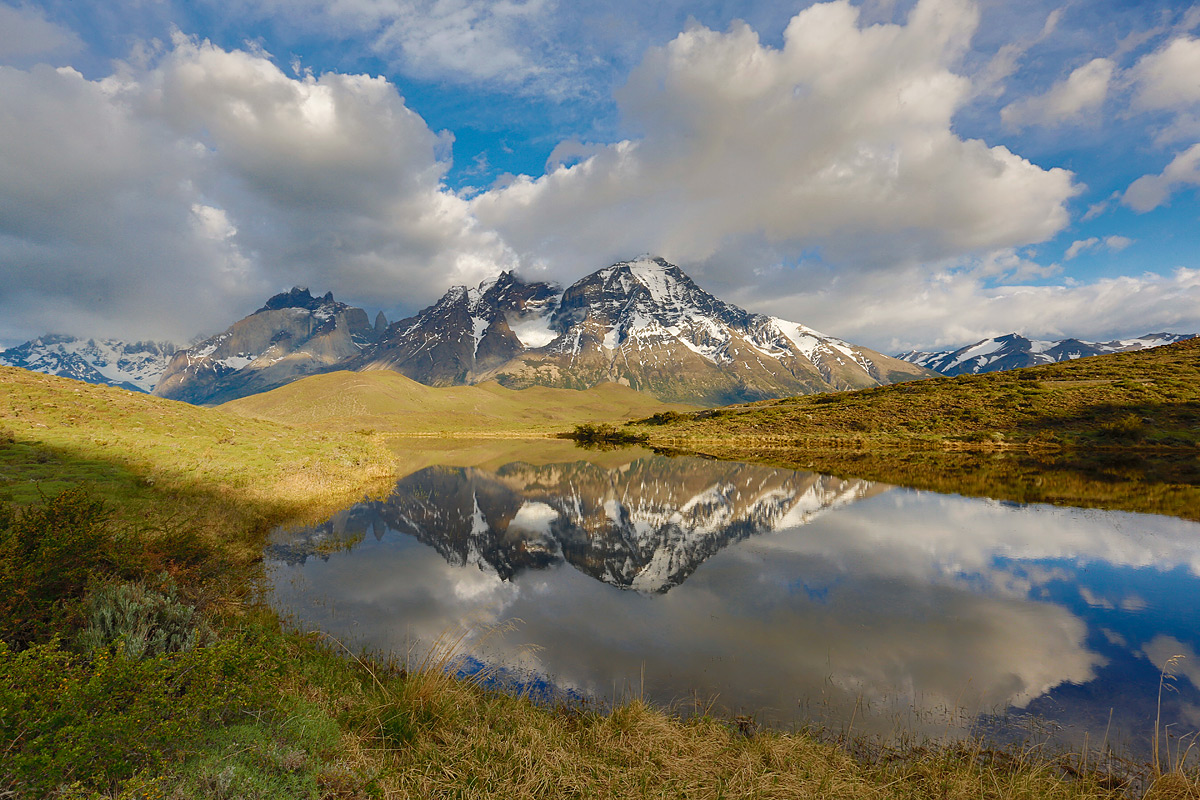
Mountain Stream in Torres del Paine, Chile:


Torres del Paine National Park is a national park encompassing mountains, glaciers, lakes, and rivers in southern Chilean Patagonia. The Cordillera del Paine is the centerpiece of the park. It lies in a transition area between the Magellanic subpolar forests and the Patagonian Steppes. The park is located 112 km north of Puerto Natales and 312 km north of Punta Arenas. The park borders Bernardo O'Higgins National Park to the west and the Los Glaciares National Park to the north in Argentine territory.Torres del Paine National Park is part of the Sistema Nacional de Áreas Silvestres Protegidas del Estado de Chile. In 2006, it measured approximately 242,242 hectares. It is one of the largest and most visited parks in Chile. The park averages around 150,000 visitors a year, of which 60% are foreign tourists,who come from all over the world.The park is one of the 11 protected areas of the Magallanes Region and Chilean Antarctica. Together, the protected forested areas comprise about 51% of the land of the region.The Torres del Paine are the peaks of the mountain range, Cerro Paine. They extend 3,050 meters above sea level, and are joined by the Cuernos del Paine. The area also boasts valleys, rivers such as the Paine, lakes, and glaciers. The well-known lakes include Grey, Pehoé, Nordenskiöld, and Sarmiento. The glaciers, including Grey, Pingo, Tyndall, and Geikie, belong to the Southern Patagonia Ice Field.

Source:
Picture:Link:
Wikipedia:Link:
Read More 1 comments

Saturday, 1 February 2014


Lake Pehoé, Chile:


Lake Pehoé is a surface water body located in Torres del Paine National Park, in the Magallanes Region of southern Chile. The lake is fed mainly by Paine River through the Nordenskjöld Lake, but it also receives the waters of the outlet of Skottsberg Lake.Paine River waters feeding the Pehoé Lake have emerged from the Salto Grande waterfall. In this upper reach of the Pehoe Lake watershed there are numerous flora and fauna, including grazing wild Guanaco.

Source:
Picture:Link:
Wikipedeia:Link:
Read More 0 comments

Saturday, 28 December 2013


Torres del Paine, Patagonia, Chile:


Torres del Paine National Park is a national park encompassing mountains, glaciers, lakes, and rivers in southern Chilean Patagonia. The Cordillera del Paine is the centerpiece of the park. It lies in a transition area between the Magellanic subpolar forests and the Patagonian Steppes. The park is located 112 km north of Puerto Natales and 312 km north of Punta Arenas. The park borders Bernardo O'Higgins National Park to the west and the Los Glaciares National Park to the north in Argentine territory.Torres del Paine National Park is part of the Sistema Nacional de Áreas Silvestres Protegidas del Estado de Chile. In 2006, it measured approximately 242,242 hectares. It is one of the largest and most visited parks in Chile. The park averages around 150,000 visitors a year, of which 60% are foreign tourists,who come from all over the world.The park is one of the 11 protected areas of the Magallanes Region and Chilean Antarctica. Together, the protected forested areas comprise about 51% of the land of the region.The Torres del Paine are the peaks of the mountain range, Cerro Paine. They extend 3,050 meters above sea level, and are joined by the Cuernos del Paine. The area also boasts valleys, rivers such as the Paine, lakes, and glaciers. The well-known lakes include Grey, Pehoé, Nordenskiöld, and Sarmiento. The glaciers, including Grey, Pingo, Tyndall, and Geikie, belong to the Southern Patagonia Ice Field.

Source:
Picture:Link:
Wikipedeia:Link:
Read More 0 comments

Wednesday, 27 November 2013


The Blue Glacier, Patagonia, Chile:


The Perito Moreno Glacier is a glacier located in the Los Glaciares National Park in southwest Santa Cruz province, Argentina. It is one of the most important tourist attractions in the Argentine Patagonia.The 250 km2 ice formation, and 30 km in length, is one of 48 glaciers fed by the Southern Patagonian Ice Field located in the Andes system shared with Chile. This icefield is the world's third largest reserve of fresh water.The Perito Moreno glacier, located 78 kilometres from El Calafate, was named after the explorer Francisco Moreno, a pioneer who studied the region in the 19th century and played a major role in defending the territory of Argentina in the conflict surrounding the international border dispute with Chile.The Perito Moreno Glacier is one of only three Patagonian glaciers that is growing. The reason remains debated by glaciologists.The terminus of the Perito Moreno Glacier is 5 kilometres wide, with an average height of 74 m above the surface of the water of Lake Argentino, in Argentina. It has a total ice depth of 170 metres.Pressures from the weight of the ice slowly pushes the glacier over the southern arm of "Lago Argentino" damming the section and separating it from the rest of the lake. With no outlet, the water-level on the "Brazo Rico" side of the lake can rise by as much as 30 meters above the level of the main body of Lake Argentina. Periodically, the pressure produced by the height of the dammed water breaks through the ice barrier causing a spectacular rupture, sending a massive outpouring of water from the Brazo Rico section to the main body of Lake Argentina. As the water exits Brazo Rico, the scored shoreline is exposed, showing evidence of the height of the water build-up. This dam–ice-bridge–rupture cycle recurs naturally between once a year to less than once a decade.The last rupture occurred on January 19th 2013, and previously, March 4th 2012, 2008, 2006, 2004, 1988, 1986, 1980, 1977, 1975, 1972, 1970, 1966, 1963, 1960, 1956, 1953, 1952, 1947, 1940, 1934 and 1917.[3] It ruptures, on average, about every four to five years.As of February 2012, before the March 2 rupture, the glacier dammed the Brazo Rico. The water level there had risen 5.6 meters.

Source:
Picture:Link:
Wikipedeia:Link:
Read More 0 comments

Friday, 22 November 2013


Torres del Paine National Park, Chile:


Torres del Paine National Park is a national park encompassing mountains, glaciers, lakes, and rivers in southern Chilean Patagonia. The Cordillera del Paine is the centerpiece of the park. It lies in a transition area between the Magellanic subpolar forests and the Patagonian Steppes. The park is located 112 km north of Puerto Natales and 312 km north of Punta Arenas. The park borders Bernardo O'Higgins National Park to the west and the Los Glaciares National Park to the north in Argentine territory.Torres del Paine National Park is part of the Sistema Nacional de Áreas Silvestres Protegidas del Estado de Chile. In 2006, it measured approximately 242,242 hectares. It is one of the largest and most visited parks in Chile. The park averages around 150,000 visitors a year, of which 60% are foreign tourists,who come from all over the world.The park is one of the 11 protected areas of the Magallanes Region and Chilean Antarctica. Together, the protected forested areas comprise about 51% of the land of the region.The Torres del Paine are the peaks of the mountain range, Cerro Paine. They extend 3,050 meters above sea level, and are joined by the Cuernos del Paine. The area also boasts valleys, rivers such as the Paine, lakes, and glaciers. The well-known lakes include Grey, Pehoé, Nordenskiöld, and Sarmiento. The glaciers, including Grey, Pingo, Tyndall, and Geikie, belong to the Southern Patagonia Ice Field.Lady Florence Dixie, in her book published in 1880, gave one of the first descriptions of the area and referred to the three towers as Cleopatra's Needles.She and her party are sometimes credited as being the first "foreign tourists" to visit the area that is now called Torres del Paine National Park.Several European scientists and explorers visited the area in the following decades, including Otto Nordenskiöld, Carl Skottsberg, and Alberto María de Agostini.Gunther Plüschow was the first person to fly over the Paine massif.The park was established in 1959 as Parque Nacional de Turismo Lago Grey and was given its present name in 1970.In 1976, British mountaineer John Garner and two Torres del Paine rangers, Pepe Alarcon, and Oscar Guineo pioneered the Circuit trail which circles the Paine massif.In 1977, Guido Monzino donated 12,000 hectares to the Chilean Government when its definitive limits were established.The park was designated a World Biosphere Reserve by UNESCO in 1978.

Source:
Picture:Link:
Wikipedeia:Link:
Read More 0 comments