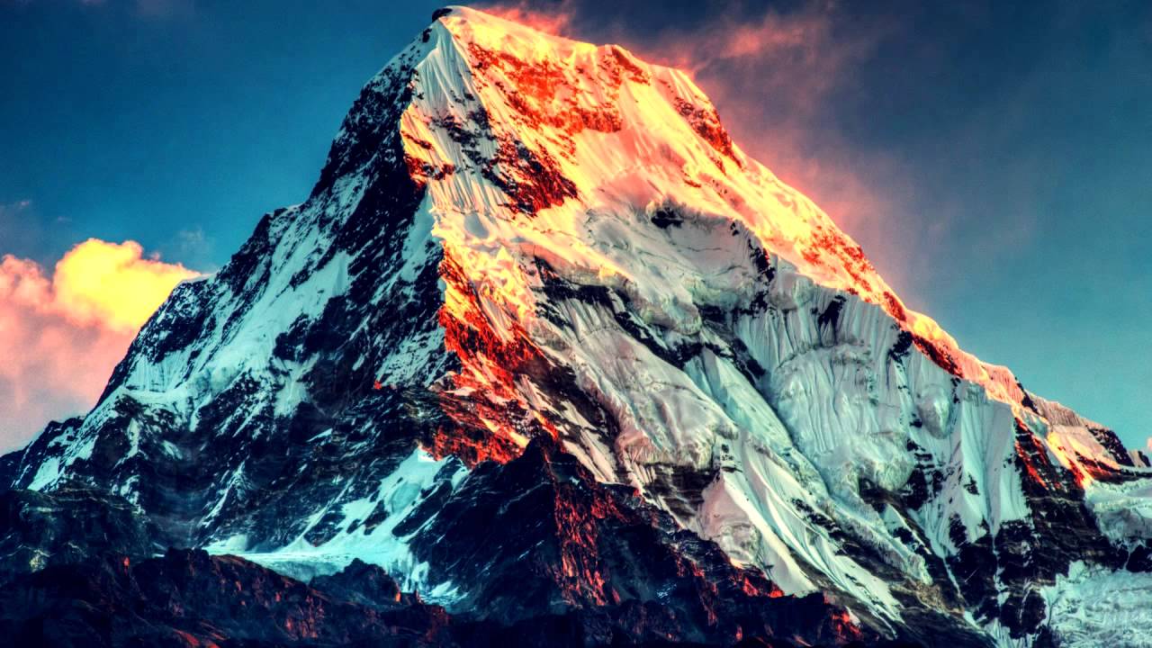
Showing posts with label Nepal:. Show all posts

Tuesday, 25 February 2014


The gateway to the high Himalaya, Namche Bazaar, Nepal:


Namche Bazaar is a village and Village Development Committee in Solukhumbu District in the Sagarmatha Zone of north-eastern Nepal. It is located within the Khumbu area at 3,440 metres at its low point, populating the sides of a hill. Namche is the main trading center and tourist hub for the Khumbu region with many Nepalese officials, a police check, post and a bank.At the time of the 2001 Nepal census, it had a population of 1647 people residing in 397 individual households.Immediately west of Namche is Kongde Ri at 6,187 metres and to the east is Thamserku at 6,623 metres.On a hill overlooking Namche Bazaar is the Syangboche Airport. It is no longer used for passenger flights. Russian helicopters make occasional cargo flights.Namche Bazaar is popular with trekkers in the Khumbu region, especially for altitude acclimatization, and is the gateway to the high Himalaya. The town has a number of lodgings and stores catering to the needs of visitors as well as a number of internet cafés, making it one of the few places in the region where trekkers can access the Internet.On Saturday mornings, a weekly market is held in the center of the village. There may also be a daily Tibetan market where clothing and cheap Chinese consumer goods tend to be the main articles for sale.


Source:
Picture:Link:
Wikipedeia:Link:
Read More 0 comments

Tuesday, 18 February 2014


World Peace Pagoda,Buddha, Lumbini, Nepal:


A Peace Pagoda is a Buddhist stupa; a monument to inspire peace, designed to provide a focus for people of all races and creeds, and to help unite them in their search for world peace. Most peace pagodas built since World War II have been built under the guidance of Nichidatsu Fujii, a Buddhist monk from Japan and founder of the Nipponzan-Myōhōji Buddhist Order. Fujii was greatly inspired by his meeting with Mahatma Gandhi in 1931 and decided to devote his life to promoting non-violence. In 1947, he began constructing Peace Pagodas as shrines to World peace.Peace Pagodas were built as a symbol of peace in Japanese cities including Hiroshima and Nagasaki where the atomic bombs took the lives of over 150,000 people, almost all of whom were civilian, at the end of World War II. By 2000, eighty Peace Pagodas had been built around the world in Europe, Asia, and the United States.The Nipponzan-Myōhōji monks of the New England Peace Pagoda were awarded the Courage of Conscience award June 5, 1998 in Sherborn, Massachusetts.


Source:
Picture:Link:
Wikipedeia:Link:
Read More 0 comments

Wednesday, 29 January 2014


High route trail near Ghyaru, Nepal


Ghyaru is a village development committee in Manang District in the Gandaki Zone of northern Nepal. At the time of the 1991 Nepal census it had a population of 332 people living in 123 individual households.


Source:
Picture:Link:
Wikipedeia:Link:
Read More 0 comments

Friday, 27 September 2013

Makalu,Nepal :

Makalu  is the fifth highest mountain in the world at 8,481 metres (27,825 ft) and is located 19 km (12 mi) southeast of Mount Everest, on the border between Nepal and China. One of the eight-thousanders, Makalu is an isolated peak whose shape is a four-sided pyramid.
Makalu has two notable subsidiary peaks. Kangchungtse, or Makalu II (7,678 m) lies about 3 km (2 mi) north-northwest of the main summit. Rising about 5 km (3.1 mi) north-northeast of the main summit across a broad plateau, and connected to Kangchungtse by a narrow, 7,200 m saddle, is Chomo Lonzo.

Source:The first attempt on Makalu was made by an American team led by William Siri in the spring of 1954. The expedition was composed of Sierra Club members including Allen Steck, and was called the California Himalayan Expedition to Makalu. This was the first American mountaineering expedition to the Himalaya. They attempted the southeast ridge but were turned back at 7,100 m (23,300 ft) by a constant barrage of storms. A New Zealand team including Sir Edmund Hillary was also active in the spring, but did not get very high due to injury and illness. In the fall of 1954, a French reconnaissance expedition made the first ascents of the subsidiary summits Kangchungtse (October 22: Jean Franco, Lionel Terray, Sardar Gyaltsen Norbu and Pa Norbu) and Chomo Lonzo (October 30(?): Jean Couzy and Terray).
Makalu was first climbed on May 15, 1955 by Lionel Terray and Jean Couzy of a French expedition led by Jean Franco. Franco, G. Magnone and Sardar Gyaltsen Norbu summitted the next day, followed by Bouvier, S. Coupe, Leroux and A. Vialatte on the 17th. This was an amazing achievement at the time to have the vast majority of expedition members summit, especially on such a difficult peak. Prior to this time, summits were reached by 1-2 people at most with the rest of teams providing logistical support before turning around and heading home. The French team climbed Makalu by the north face and northeast ridge, via the saddle between Makalu and Kangchungtse (the Makalu-La), establishing the standard route
Picture:Link:
Wikipedia:Link:
Read More 0 comments

Monday, 23 September 2013

Mount Everest,Nepal:


Mount Everest  is the Earth's highest mountain, with a peak at 8,848 metres (29,029 ft) above sea level and the 5th tallest mountain measured from the centre of the Earth. It is located in the Mahalangur section of the Himalayas. The international border between China and Nepal runs across the precise summit point. Its massif includes neighboring peaks Lhotse, 8,516 m (27,940 ft); Nuptse, 7,855 m (25,771 ft) and Changtse, 7,580 m (24,870 ft).
In 1856, the Great Trigonometric Survey of British India established the first published height of Everest, then known as Peak XV, at 29,002 ft (8,840 m). The current official height of 8,848 m (29,029 ft) as recognized by Nepal and China was established by a 1955 Indian survey and subsequently confirmed by a Chinese survey in 1975. In 1865, Everest was given its official English name by the Royal Geographical Society upon a recommendation by Andrew Waugh, the British Surveyor General of India. Waugh named the mountain after his predecessor in the post, Sir George Everest. Although Tibetans had called Everest "Chomolungma" for centuries, Waugh was unaware of this because Tibet and Nepal were closed to foreigners at the time thus preventing any attempts to obtain local names.
Mount Everest attracts many highly experienced mountaineers as well as capable climbers willing to hire professional guides. There are two main climbing routes, one approaching the summit from the southeast in Nepal (known as the standard route) and the other from the north in Tibet. While not posing substantial technical climbing challenges on the standard route, Everest presents dangers such as altitude sickness, weather, wind as well as significant objective hazards from avalanches and the Khumbu Icefall. While the overwhelming majority of climbers will use bottled oxygen in order to reach the top, some climbers have summitted Everest without supplemental oxygen

source:
Picture:Link:
Wikipedia:Link:
Read More 0 comments